This community concern runs through 5C07, but also along the boundary of 5C06 and 5C02. Possible extensions north could cross 5B06, 5B02, and 5B01.
tl;dr
- The 18th St NE bicycle/mobility lanes are a set of painted “climbing” lanes on 18th St NE running in some form for the half mile from Montana Ave NE to Rhode Island Ave NE
- The climbing lane design involves lanes only on one or the other side of the roadway (with sharrows on the other side), to give dedicated space for bikes only in the uphill direction (to keep bikers out of the way of drivers)
- This design is confusing and unsafe for bikers and drivers alike; the double-yellow median frequently jumps around with the bike lanes
- It is unclear if DDOT still considers climbing lanes acceptable design, although upgrading the 18th St bike lanes isn’t immediately in DDOT’s work plan
- A number of nearby infrastructure improvements, geographic constraints, and family-centric amenities make it especially important that we upgrade the infrastructure we have as we seek to extend it from Montana to Michigan
- Our best chance to queue up an upgrade (and expansion) is in DDOT’s upcoming Strategic Bikeways Plan (SBP) which began engagement in 2024 and should be completed by early 2026.
- ANC 5C has endorsed upgrading these bike lanes unanimously as part of our January 2024 Resolution on Comprehensive Public Safety
The Need
As DC’s low-stress bicycle/mobility priority network grows, we need to keep in mind the necessity for safe and accessible infrastructure along 18th St. There are many reasons, further detailed below:
- there are unique geographic constraints making 18th and Montana a critical connection
- there are many unique and family-focused amenities along the corridor
- this connectivity is considered in the existing MoveDC Bicycle Priority plan
- there are a number of substantial investments in new bicycle/mobility infrastructure being made nearby
Connectivity
18th St (combined with a segment of Montana Ave) is the middle of only three connections over the railyard and tracks extending east from the Metropolitan Branch tracks/trail. The three connections, from west to east, are:
- Brentwood Rd NE/9th St NE
- 18th St NE/Montana Ave NE
- Queens Chapel Rd NE/Bladensburg Road NE
South Dakota Ave and Eastern Ave each pass over the northern track line only before connecting to New York Ave where it’s essentially in interstate form.
Amenities
The 18th St corridor is home to nine schools, many daycares, six parks, two rec centers, a library, a public pool, a large senior assisted living facility, a pediatric rehabilitation center, two forest patches, large institutional facilities, and several anticipated large-scale developments, making safe and corridor-long connectivity crucial.
The existing (in need of improvement) bicycle/mobility lanes connect Woodridge Library, Langdon Park, Langdon Elementary, and the DACL assisted living facility.
specifics
Institutions along the whole corridor spelled out:
- many schools
- 2-3 DCPS elementary schools (Langdon ES, John Burroughs ES; Bunker Hill ES is just a bit off the corridor)
- the Taft Middle School building, which currently houses:
- three charter schools (Perry St Prep, Sojourner Truth, Latin American Bilingual Montessori (LAMB))
- a private school (St. Jerome Institute)
- a dance school (Princess Mhoon Dance Institute (PMDI))
- a school’s makerspace (Center City Public Charter’s upcoming facility on the 2300 block)
- many daycares:
- Gatari Child Development Center (just off the corridor in Ivy City)
- Kiddie Blossom University (opening soon on the 2800 block)
- Bellas Artes (a block west on RIA)
- Petit Scholars RIA (two blocks east on RIA)
- Woodbridge Daycare (3300 block)
- 18th Street Early Learning (3400 block)
- Prep Enrichment Center (3400 block)
- Children of the Future (two blocks east on Bunker Hill)
- one of Ward 5’s only two Public Libraries (Woodridge Neighborhood Library)
- 4-6 parks:
- Arboretum playground/rec center (just off Montana)
- Loomis Park
- Langdon Park
- publicly accessible playground and field as Burroughs ES
- Dwight Mosley Park and Taft Field
- Bunker Hill Triangle Park
- Langdon Park’s many unique amenities for the area: a soon-to-be-modernized recreation center, a public pool, a skate park
- a senior assisted living facility (Department of Aging and Community Living’s center on the 2500 block)
- a pediatric rehabilitation facility (Children’s National’s HSC Pediatric Center)
- two pediatric dentists:
- Ivy City Pediatric Dentistry (just off the corridor in Ivy City)
- Children’s Choice Pediatric Dentistry (a couple block to the east on Bunker Hill)
- two forest patches (Langdon Park’s and the South Langdon/Queens Chapel/Paper Street Forest Patch)
- Douglas Development’s NewCityDC project
- other large institutional landmasses (Howard University Divinity School, Franciscan Monastery, and US Arboretum just off the corridor)
- important retail areas:
- Ivy City/Hecht Warehouse
- around 18th/Montana
- along Rhode Island Ave
- around 18th/Monroe
- around 20th/Bunker Hill
- a high-frequency bus corridor along Rhode Island Ave (with 18th itself serving as a critical connector via the E2 line from Fort Totten to Ivy City)
MoveDC plan
DDOT’s MoveDC Bicycle Priority plans include plans for future improvement along all of Montana Ave, and 18th St north from the existing lanes to South Dakota Ave NE. 18th St provides a uniquely necessary north-south route parallel with the existing (and now finally complete) MBT/8th St route.
Montana from Bladensburg to 18th
This span is anticipated in the MoveDC plans and has no existing infrastructure or planned improvements along Montana. It runs along the NewCityDC development site (currently temporary WMATA bus storage) and connects to Bladensburg on the south. This segment is bisected by a notoriously unsafe virtual circle, generally called Montana Circle, which DDOT does at some point anticipate rebuilding.
This span of Montana Ave has variable crosswidth, with the areas around Montana Circle being chaotic and interrupted, and the consistent spans being different widths north and south of it. The two spans are:
- 38’ wide north of Montana Circle, with two travel lanes in each direction and no street parking. Implementing protected bike lanes for this span would likely involve taking a travel lane and replacing another with a median and left-turn “pocket” lanes; this is a 4:3 road diet.
- 42’ wide south of Montana Circle, with one travel lane and one street parking lane in each direction. Implementing protected bike lanes for this span would likely involve taking a parking lane; parking here is not heavily in use, though there are some residences using street parking on the west side of the span.
18th from Montana to RIA
This span has existing lanes, though they’re unprotected and inconsistent.
As the roadway is 42’ wide, with 37’ consistently allocated north of Bryant to one travel lane and one parking lane in each direction, implementing consistent and protected lanes here would likely require eliminating one parking lane. Parking here is low-utilization; on the east side, 18th runs along Langdon Park and the DACL assisted senior living facility (which has a parking lot fronting 18th). This lane sees intermittent non-resident use. On the west side, residents mostly make use of off-street parking.
RIA to Irving
This span is marked as having existing infrastructure in the MoveDC plans, but there hasn’t been any since around 2015 when the roadway was repaved and the lanes weren’t repainted. At around 35’ of crosswidth with only one travel lane in each direction and no parking, this roadway is already primed for introducing bike lanes, as it would just be a matter of right-sizing the travel lanes and would not remove any existing parking.
I’m hopeful at least a quick painted extension of the existing lanes (mirroring the span from Montana to Bryant) could occur as part of the public space work for the 1800 Hamlin St NE development.
Should an upgrade south of RIA occur, we should seek to get this span included as it’s considered existing by the MoveDC map and should be an easy lift.
Irving north
This span is anticipated in the MoveDC plans up to South Dakota Ave NE, though the roadway characteristics remain the same all the way to just shy of Michigan (and continuing northbound in phases should be a longer-term goal).
At 29’ of crosswidth and containing important two-way bus service (and parking along one side only), finding a way forward here will be tricky. Some options include:
- Splitting bus and/or bicycle/mobility infrastructure between 18th and 20th, two consistently parallel collector roads from Evarts to Varnum.
- Eliminating the parking lane entirely, and leaving 10’ for bus and car traffic in each direction with 9’ left for a two-way cycletrack including buffer
I’m on the lookout for other options/ideas here.
Some notes on the street parking here (moving south to north):
- Irving to Newton: residential parking usage is relatively low, and could likely be carried over to cross streets
- Newton to Otis: the 3600 block is a dense stretch of rowhouses with heavy street parking utilization; buy-in from these residents would be important
- Randolph to SDA: This is a transitional block with no parking and a left-turn pocket lane onto SDA for northbound traffic; some considerations here could be given as part of the upcoming South Dakota Ave project
- SDA to Varnum/Michigan: The parking lane switches from the west/southbound side to the east/northbound side
Nearby Projects
A number of important projects are moving forward nearby, and better connectivity on and around 18th St NE will be critical for connectivity to and among them. These projects include:
- The 8th St safety improvements, nearing completion, which implemented a protected two-way cycletrack on 8th St NE to bridge the gap between the two existing segments of the Metropolitan Branch Trail (MBT), creating a comprehensive north-south route just under a mile west of 18th St NE
- The New York Ave NE trail project to create mixed-used trails on either side of New York Ave NE
- The Bladensburg Road Multimodal Safety and Access Study which would implement curbside protected bicycle/mobility lanes across the entire span of Bladensburg Road NE
- The Mount Olivet Rd multimodal improvements to implement a protected two-way cycletrack on Mount Olivet Road from 9th/Brentwood to Bladensburg
- Taylor St NE improvements may create a new east-west low-stress route from the MBT to some eastern terminus (possibly as far as SDA or 18th St)
Advocacy
In the absence of any serious plans to improve 18th St, I’ve been trying to keep this on DDOT’s radar as I submit comments for tangentially related matters, such as:
- Letter in Support of NOI-23-158-TESD for an all-way stop control at 18th/Bryant
- Letter in Support of NOI-23-161-PSD to fill the two-block gap in painted K St NE bicycle/mobility lanes separating them from the southern terminus of the West Virginia Ave lanes (which would connect across New York Avenue to Montana Ave/18th St to the north)
Community Action
Absent any other clear focus, email advocating for improvements and expansions to the 18th St bicycle/mobility lanes can be emailed to DDOT’s Community Engagment Specialist for Ward 5, Dalando Baker (dalando.baker@dc.gov). Feel free to CC me (5c07@anc.dc.gov) and Conor from CM Parker’s office (cshaw@dccouncil.gov).
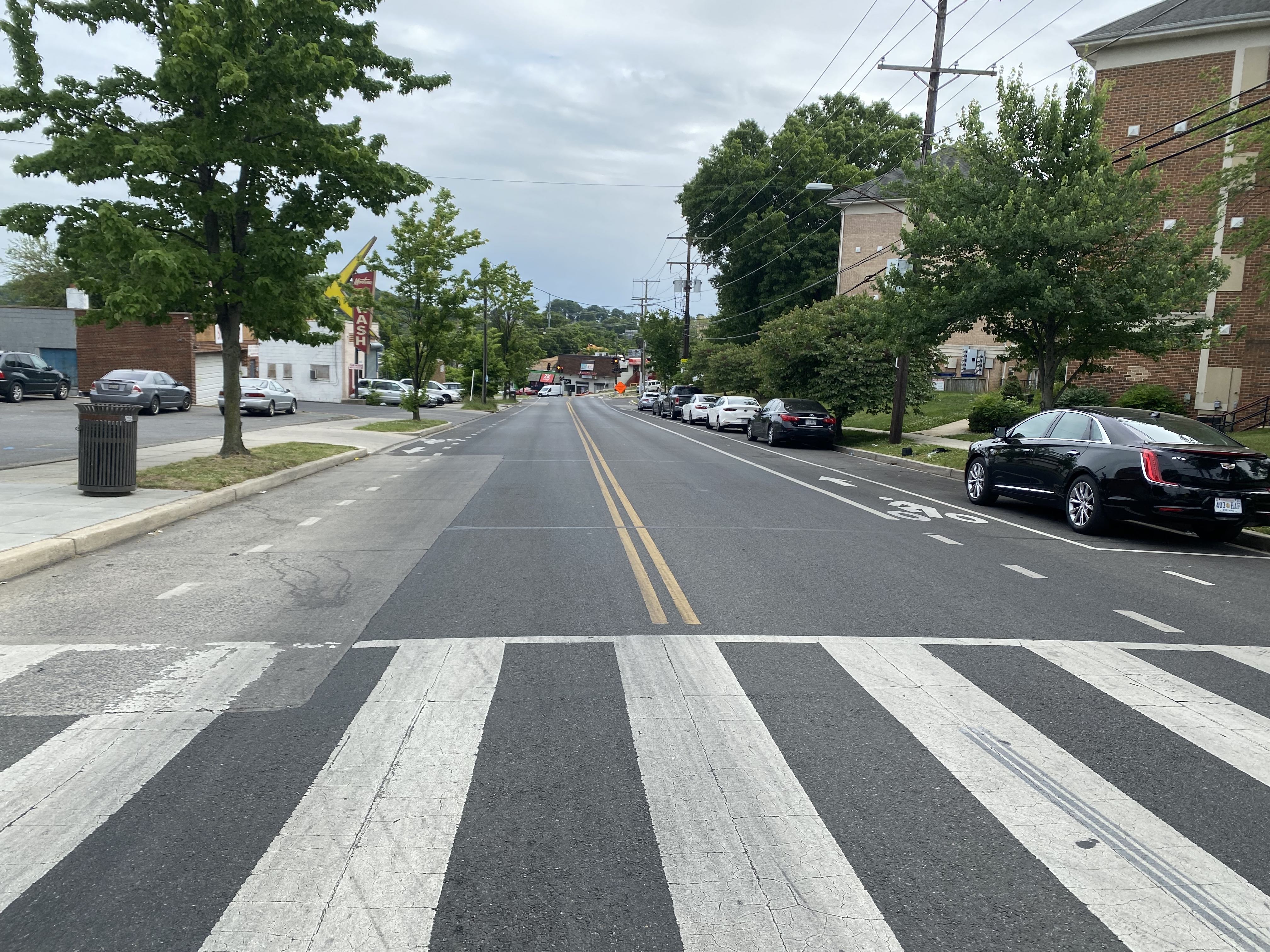
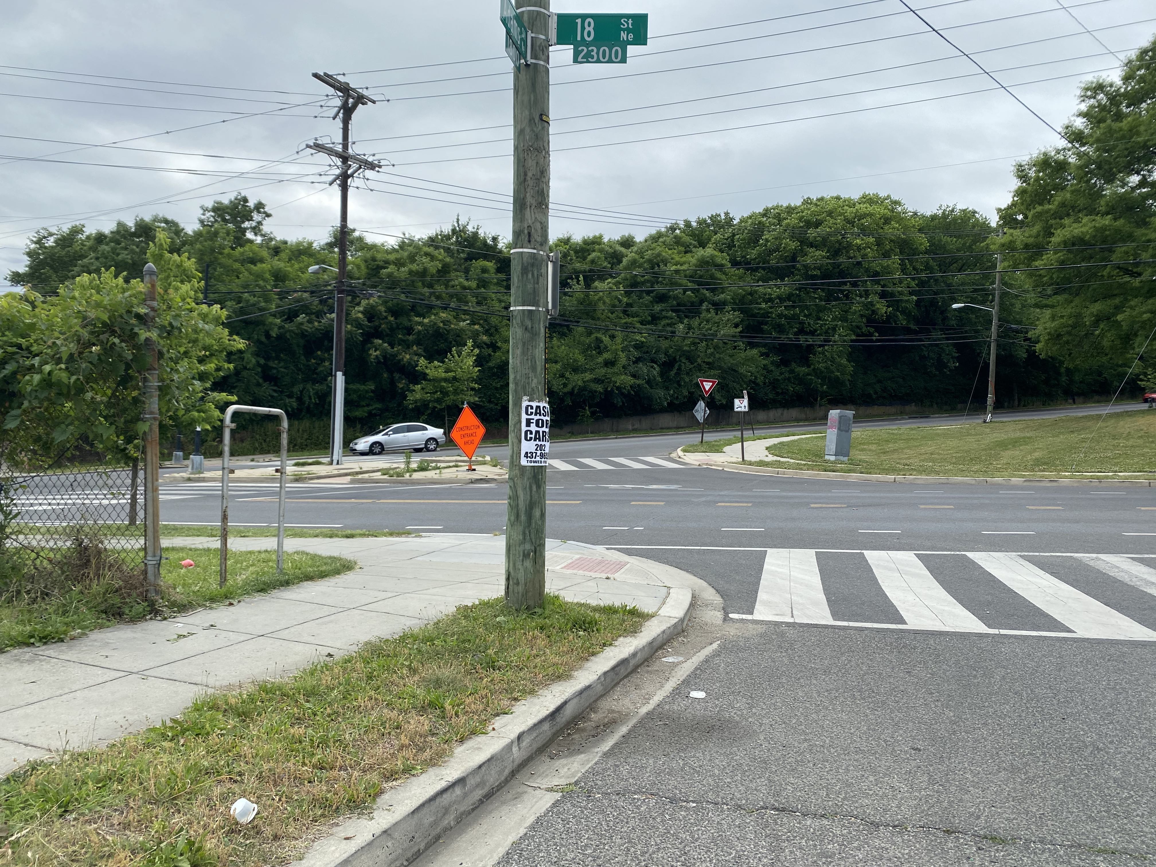
Present Condition
From Montana Ave NE to Rhode Island Ave NE, 18th St NE is 42 feet wide, typically divided as follows, from west to east:
- 8-foot south-bound delineated parking lane
- 10-foot south-bound driving lane
- a double-yellow center line
- 10-foot north-bound driving lane
- 8-foot north-bound delineated parking lane
- a 5-foot bike lane, running between the parking lane and driving lane in one given direction
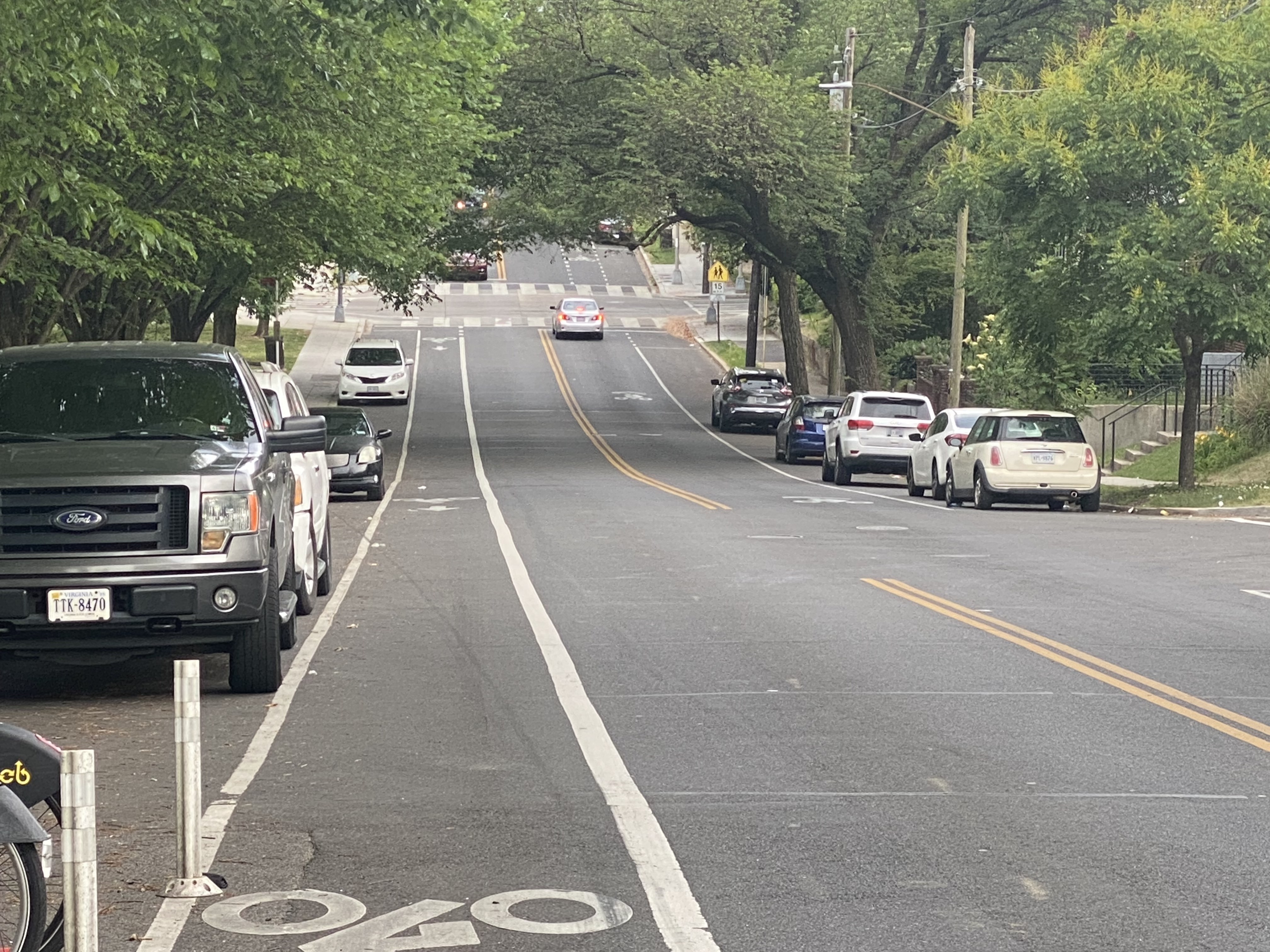
Montana to Bryant
Looking south from Bryant
This is the only segment that deviates from the above standard form, and for which the bike lanes run in both directions.
- north-bound the 5-foot painted bike lane runs between a 13-foot driving lane and the curb, in an area with a few very wide curb cuts
- south-bound the 5-foot painted bike lane runs between an 8-foot delineated parking lane and a 10-foot drive lane
Bryant switch
Looking north to Bryant
At Bryant, which has decent visibility, the roadway realigns to standard form on the north side:
- north-bound the bike lane jumps to the left to accommodate the introduction of a north-bound parking lane and a shrinking (13 feet to 10 feet) north-bound drive lane
- south-bound sharrows become a painted bike lane
- the double-yellow center-line jumps to the west looking north, with a dotted guideline painted through the intersection
Bryant to Douglas
Looking south to Bryant
For the stretch from Bryant to Douglas, the roadway resembles the standard form above, with the bike lane north-bound and sharrows south-bound.
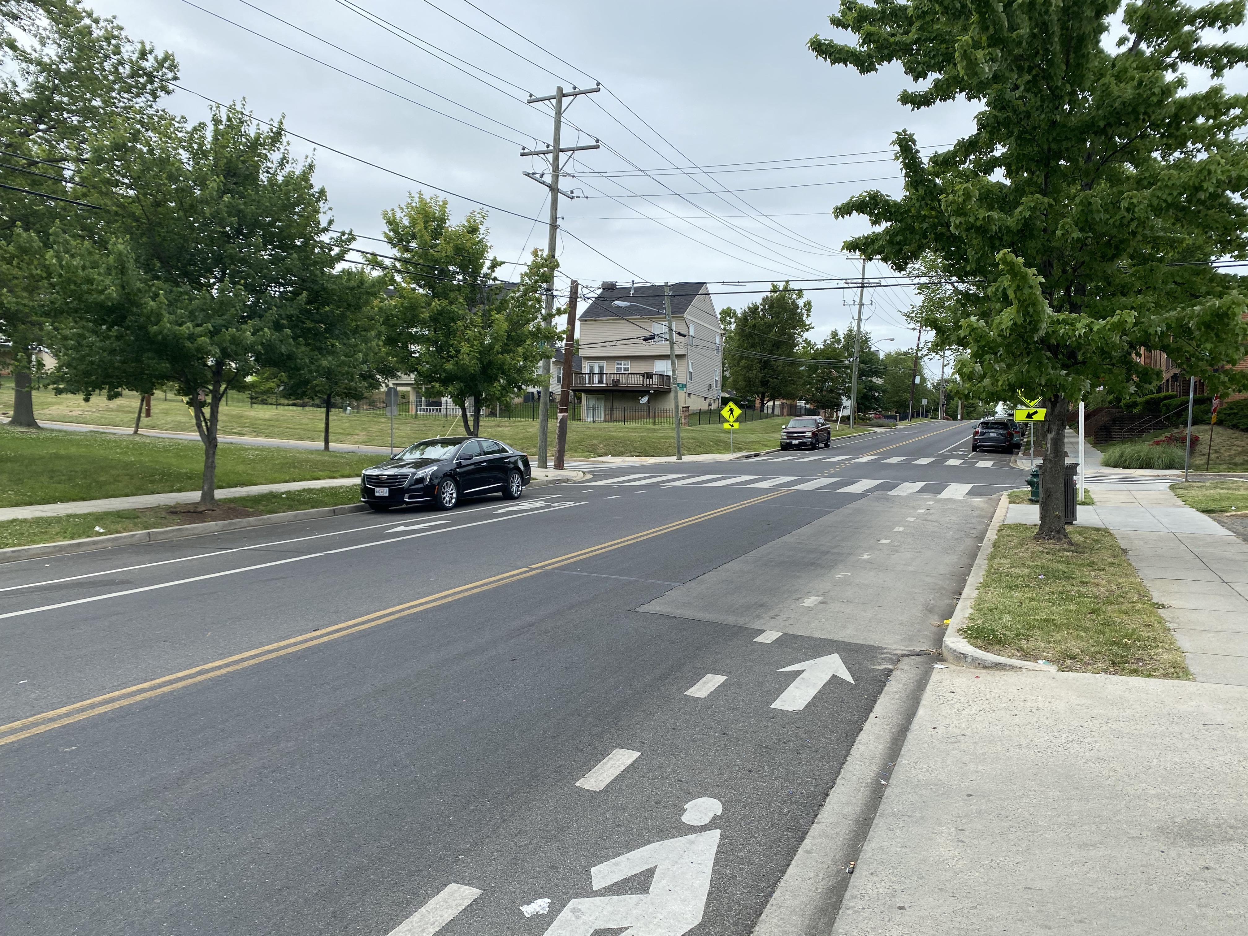
Douglas switch
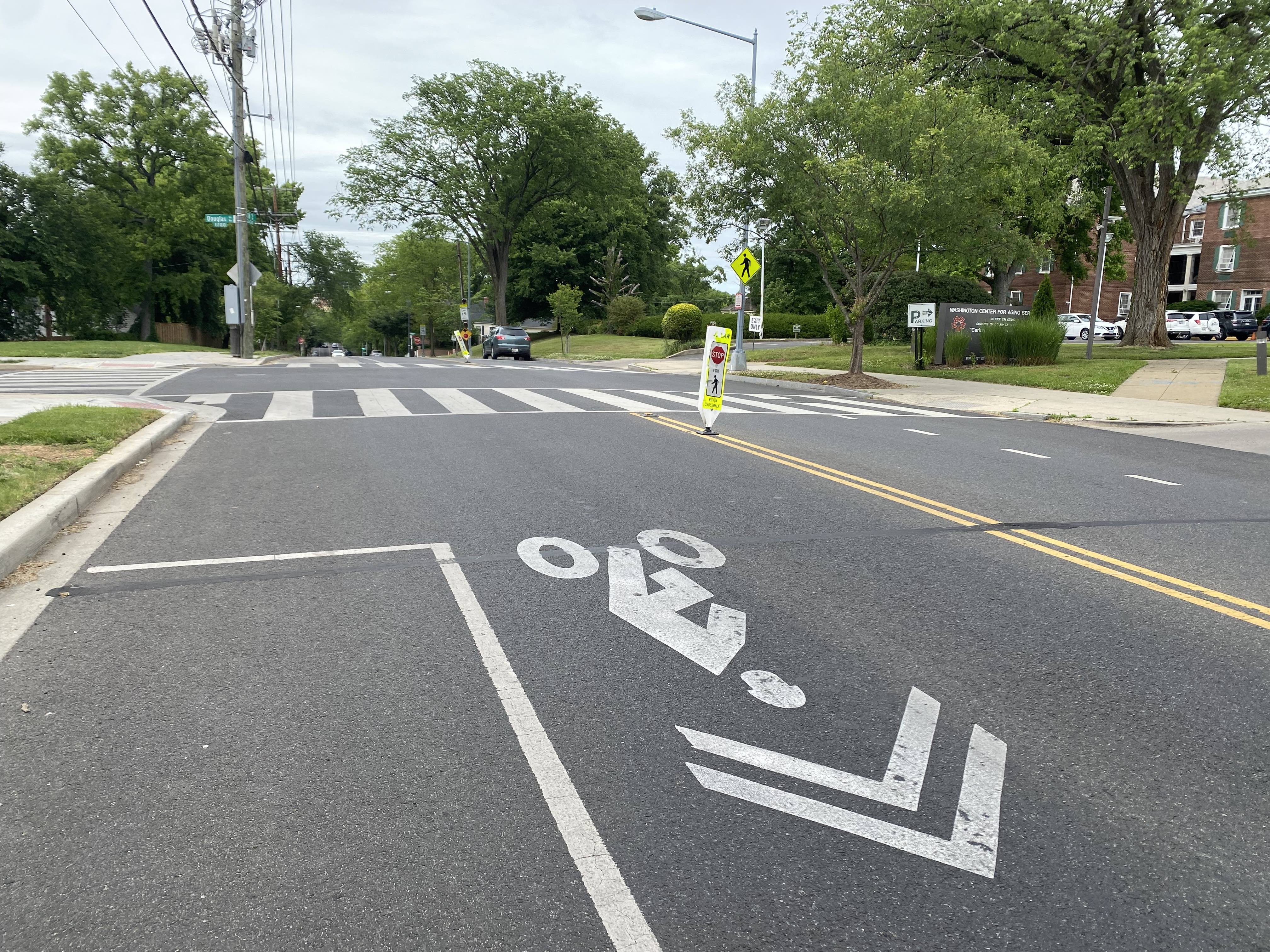
Looking north to Douglas
Douglas and 18th is a three-way intersection, with the Center for Aging facility parking lot entrance on the east side just north and south of the intersection. The north-bound and south-bound bike lanes both end into sharrows in their respective direction over a blind hill at a pair of unsignalized crosswalks.
This is the only switch in which the road’s center line does not jump.
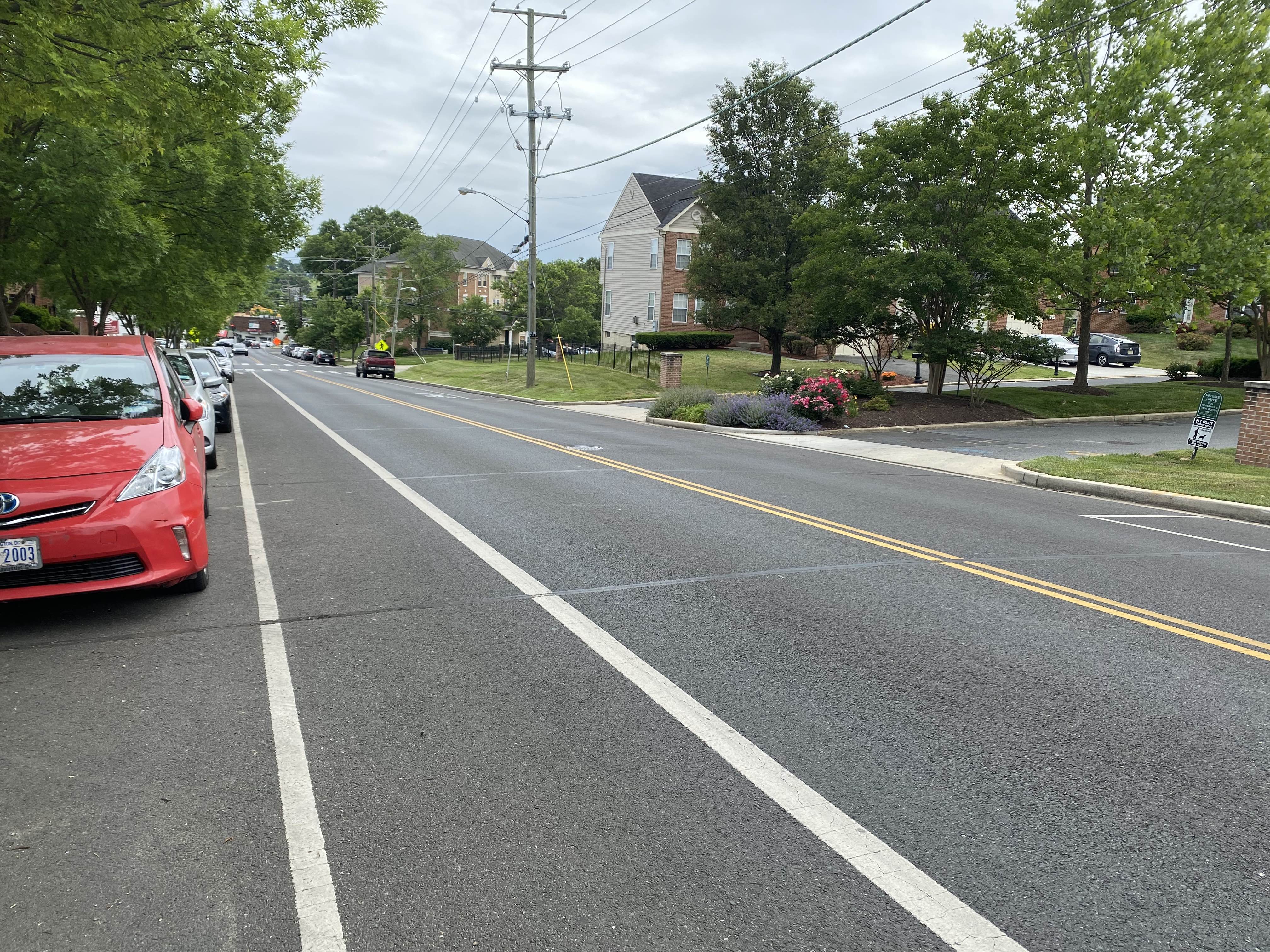
Douglas to Franklin
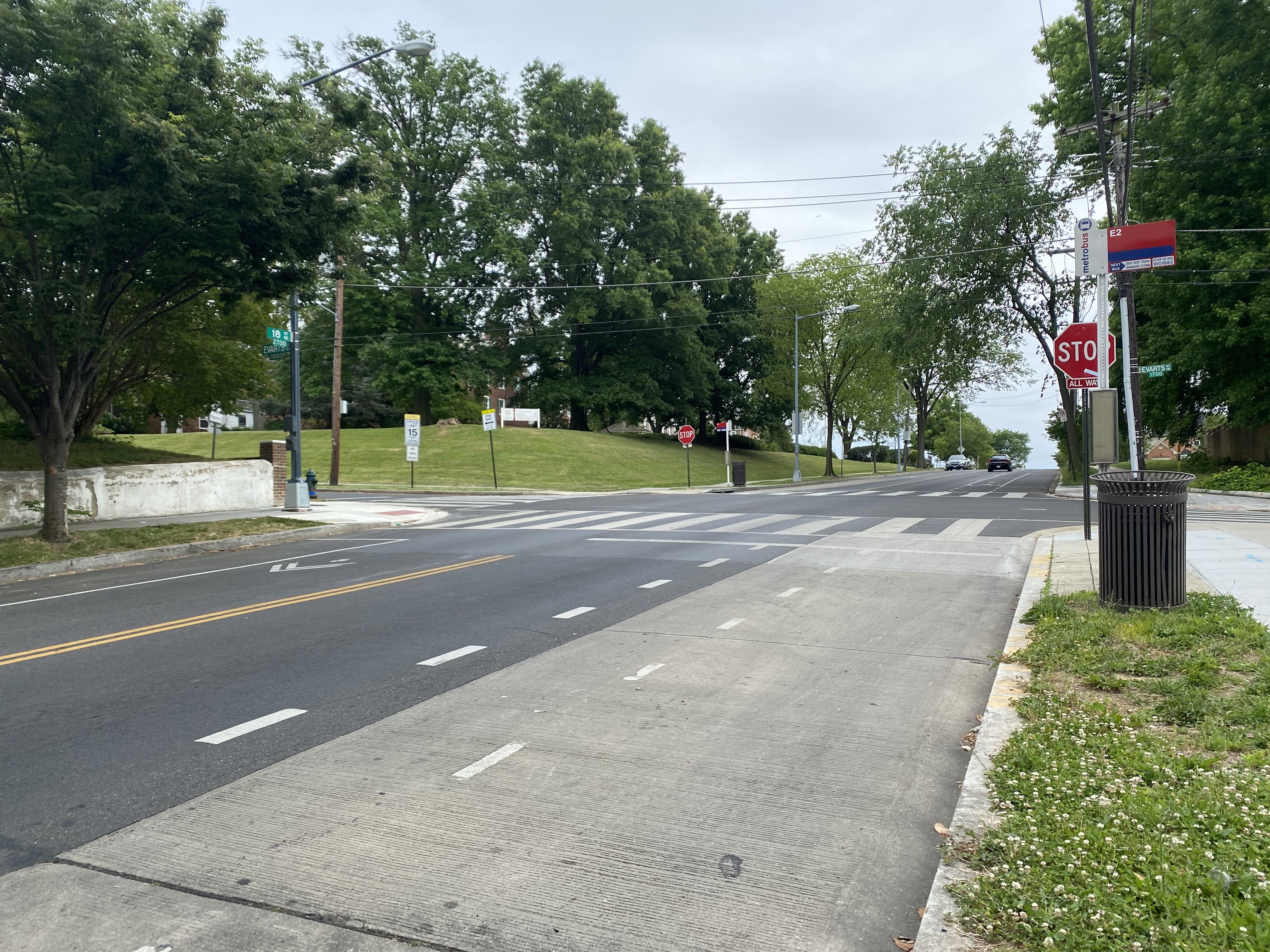
Looking south to Evarts
For the stretch from Douglas to Franklin, the roadway resembles the standard form above, with the bike lane south-bound and sharrows north-bound.
Franklin switch
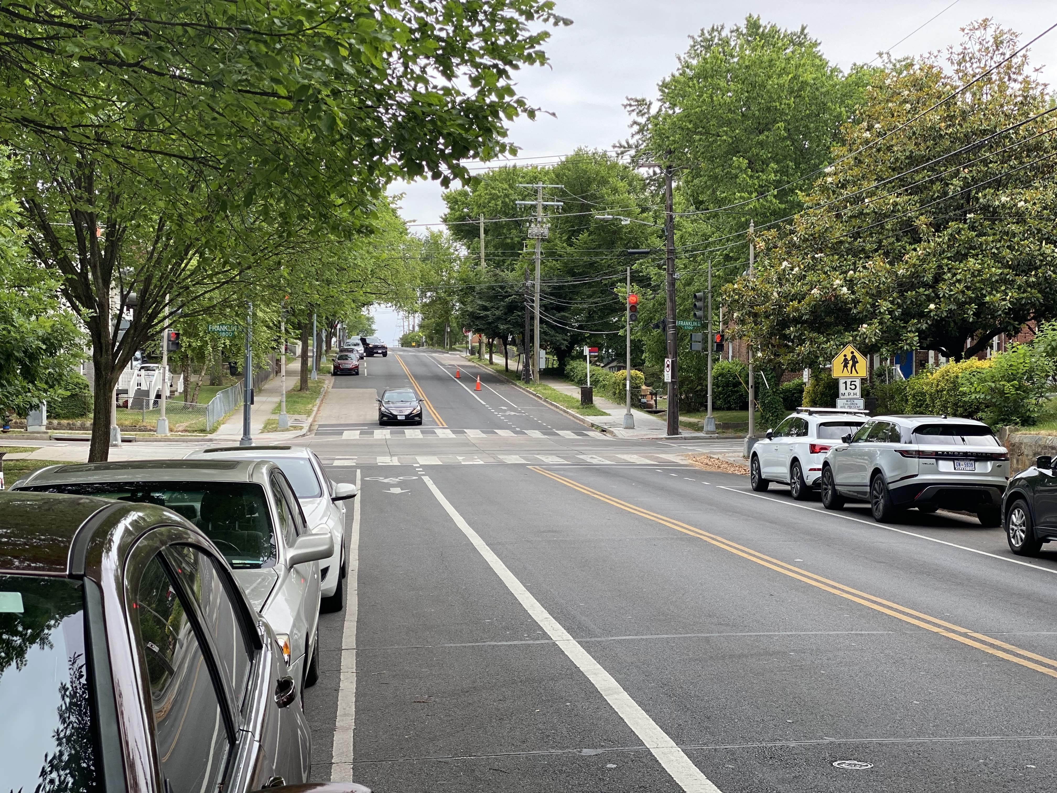
Looking south to Franklin
At Franklin, a dip in the road makes for heightened visibility as sharrows switch to painted lanes in each direction. The center-line jumps, without a dotted guideline through the intersection.
Franklin to Rhode Island
Looking south from the CaBi dock
For the stretch from Franklin to Rhode Island, the roadway resembles the standard form above with the bike lane north-bound and sharrows south-bound.
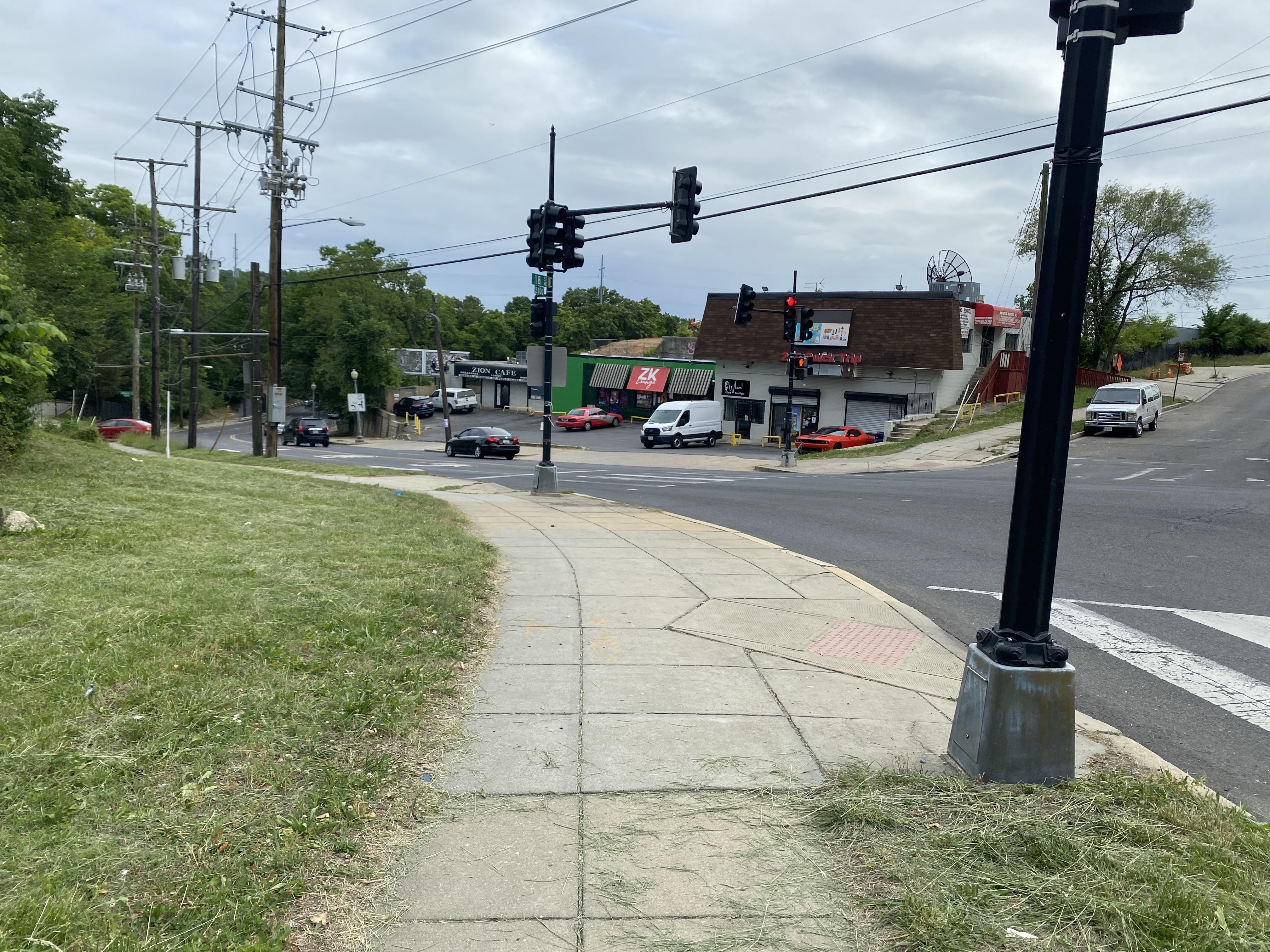
RIA intersection
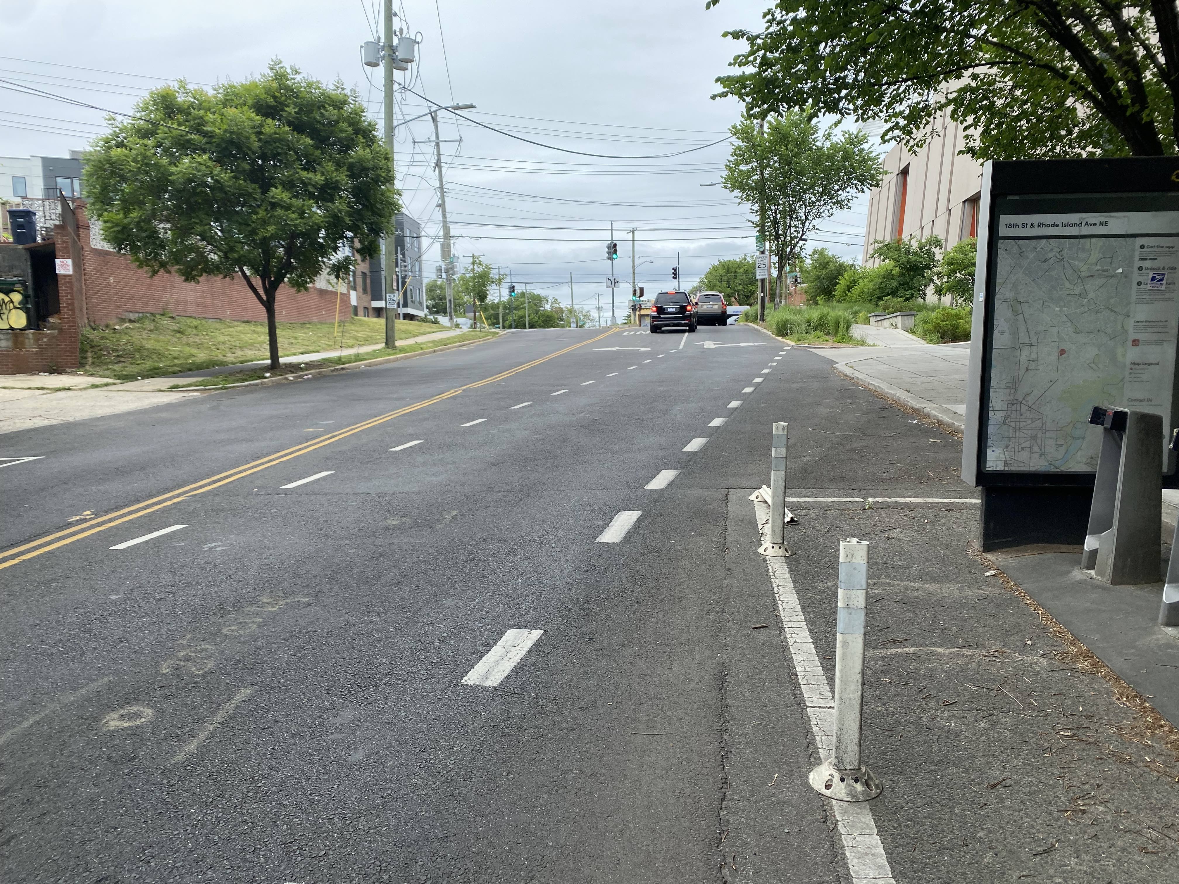
Looking north to RIA
Just before the Woodridge Library parking lot, an on-street Capital Bikeshare dock is present in the parking lane, and north of that, the bike lane veers into the library curb cut to make room for a left-turn pocket lane onto Rhode Island Ave.
Adjacent roadways
Montana and south
Looking west from Adams
A slip lane carries 18th St right on Montana.
Looking south to Montana and W
18th St itself veers right to a segment of W St largely fronting a DDOT facility and ending at a pocket park with no through access for drivers.
Turning left onto Montana from 18th leads to a short segment passing under railroad track and to Montana Circle; the junction of Montana, New York, and West Virginia Avenues.
North of RIA
18th St shrinks considerably north of RIA, with a 32-37 foot wide fluctuation from RIA to Irving, and then a standard 29-foot crosswidth (with a double-yellow line and parking only southbound) up to past South Dakota Ave.