For background on terms like “ANC” and “SMD”, check the lexicon.
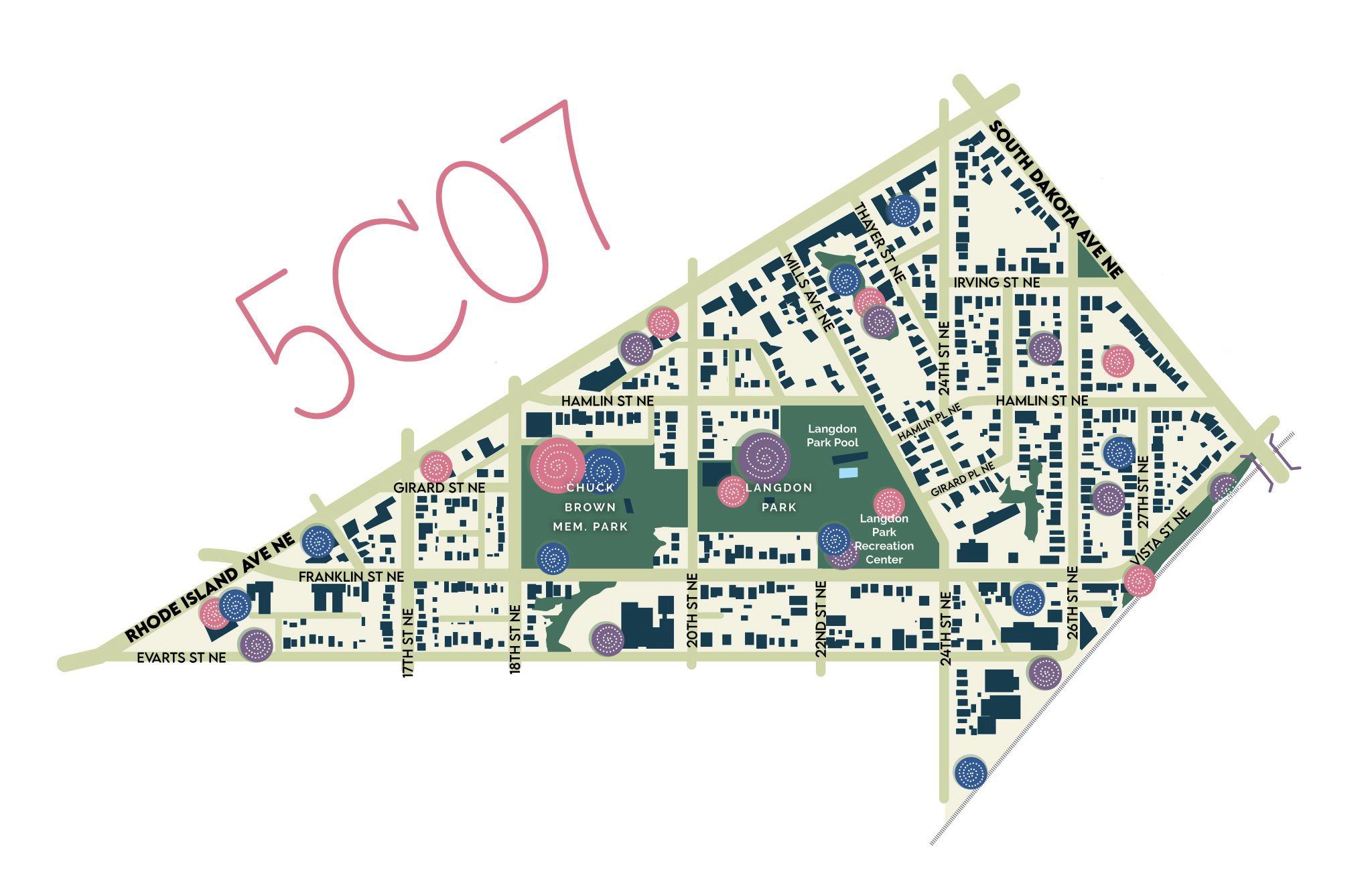
SMD 5C07 contains the northern portions of the Langdon neighborhood in DC’s Ward 5. As neighborhood boundaries are not formally defined, some might also consider portions to be part of Woodridge, Brentwood, or even Brookland, with varying levels of (dis)agreement.
boundaries
5C07 is bounded by:
- Rhode Island Ave. NE to the northwest
- South Dakota Ave. NE to the northeast
- Evarts St. NE to the south
- the B&O railroad tracks (i.e. those carrying the MARC Camden line and staying north of Bladensburg Rd. NE) to the southeast
- 24th St. NE bounds a small triangle south of Evarts, to the west
amenities
Our district contains many important public facilities, including:
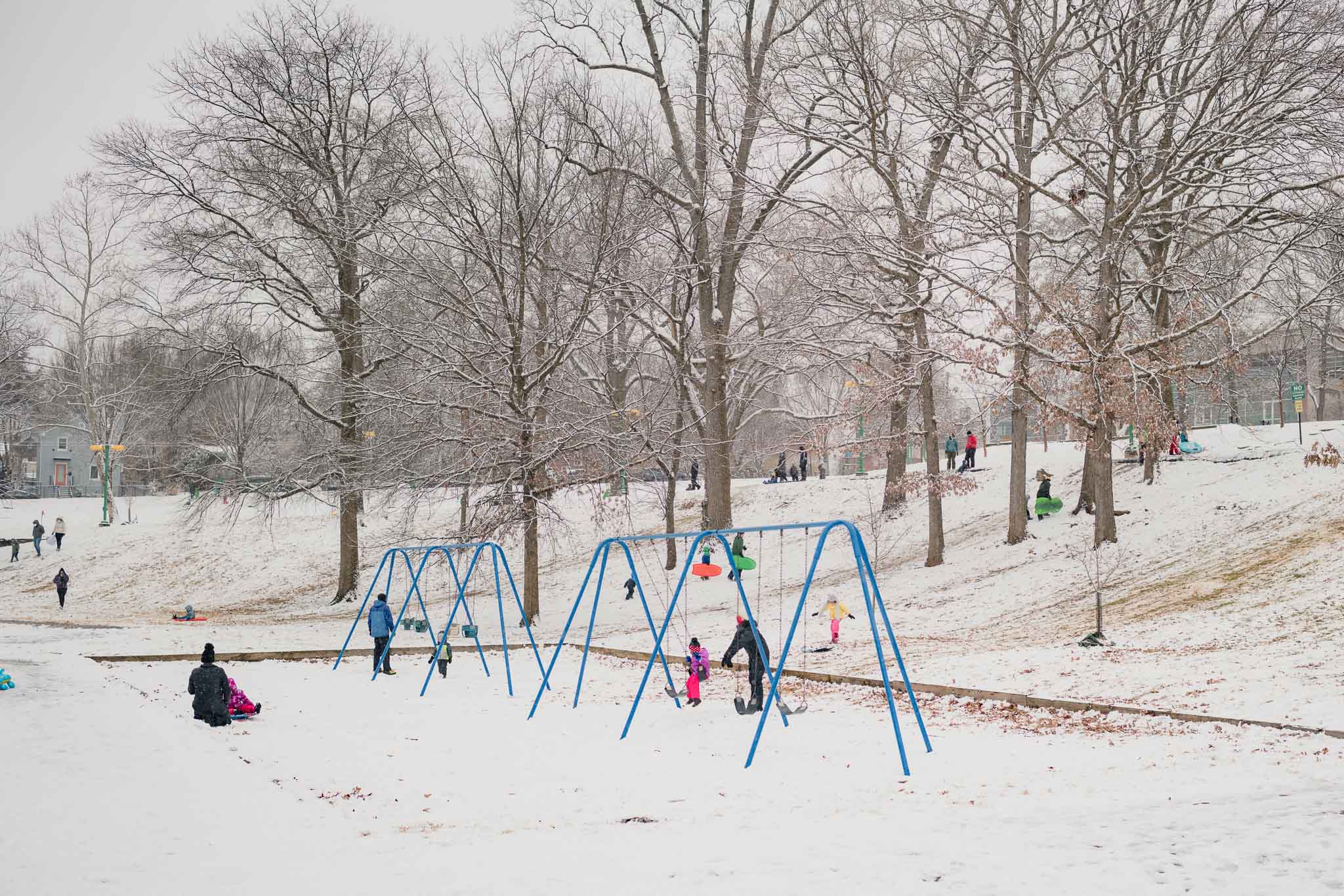
- Langdon Park: a sprawling park containing a playground, picnic area, many indoor and outdoor athletic facilities, dog park, a community garden, a pool with spray fixtures, and a forest patch.
- Woodridge Library: a recently rebuilt three-story neighborhood library with dedicated kids area, meeting rooms, computer lab, and roofdeck.
- Langdon Elementary: a distinguished DC Public School featuring an accredited Montessori curriculum program
by the numbers
5C07 contains:
- 1819 residents by 2020 Census numbers. Per DC Code, SMDs are meant to contain 2000±100 residents, based on the preceding decennial US Census. Our SMD is undersized by this standard, in part due to a late movement of 156 residents in the triangle bounded by Rhode Island Ave. NE, 20th St. NE, and Kearny St. NE, from 5C07 to 5B06.
- 1446 registered voters by July 2022 DC BOE data.
- 634 2022 General Election voters by certified November 2022 DC BOE data.
more maps
In an attempt to accessibly convey these boundaries on flyers, I ended up with a few different maps. These were meant to approximate the shorthands I’d developed while talking to folks (“south of Rhode Island Ave. from the Walgreens to the Rita’s”; “everything around Langdon Park”), available without my narration and without the cruft of a Leaflet map (like the one at the top of this page) or confusion of listing boundary roads or landmarks.
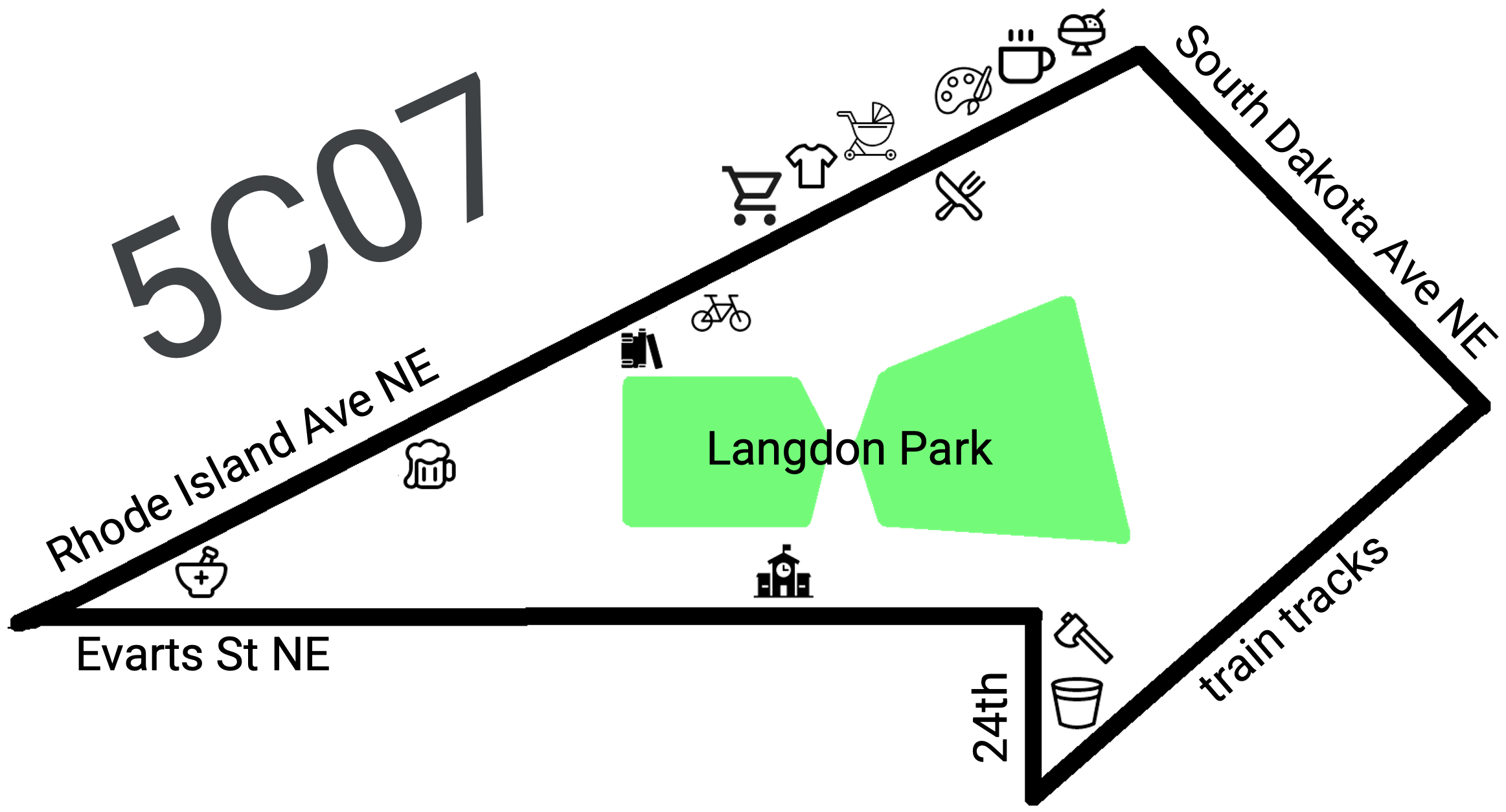
the one I use for quarter-page inkjet-printed flyers
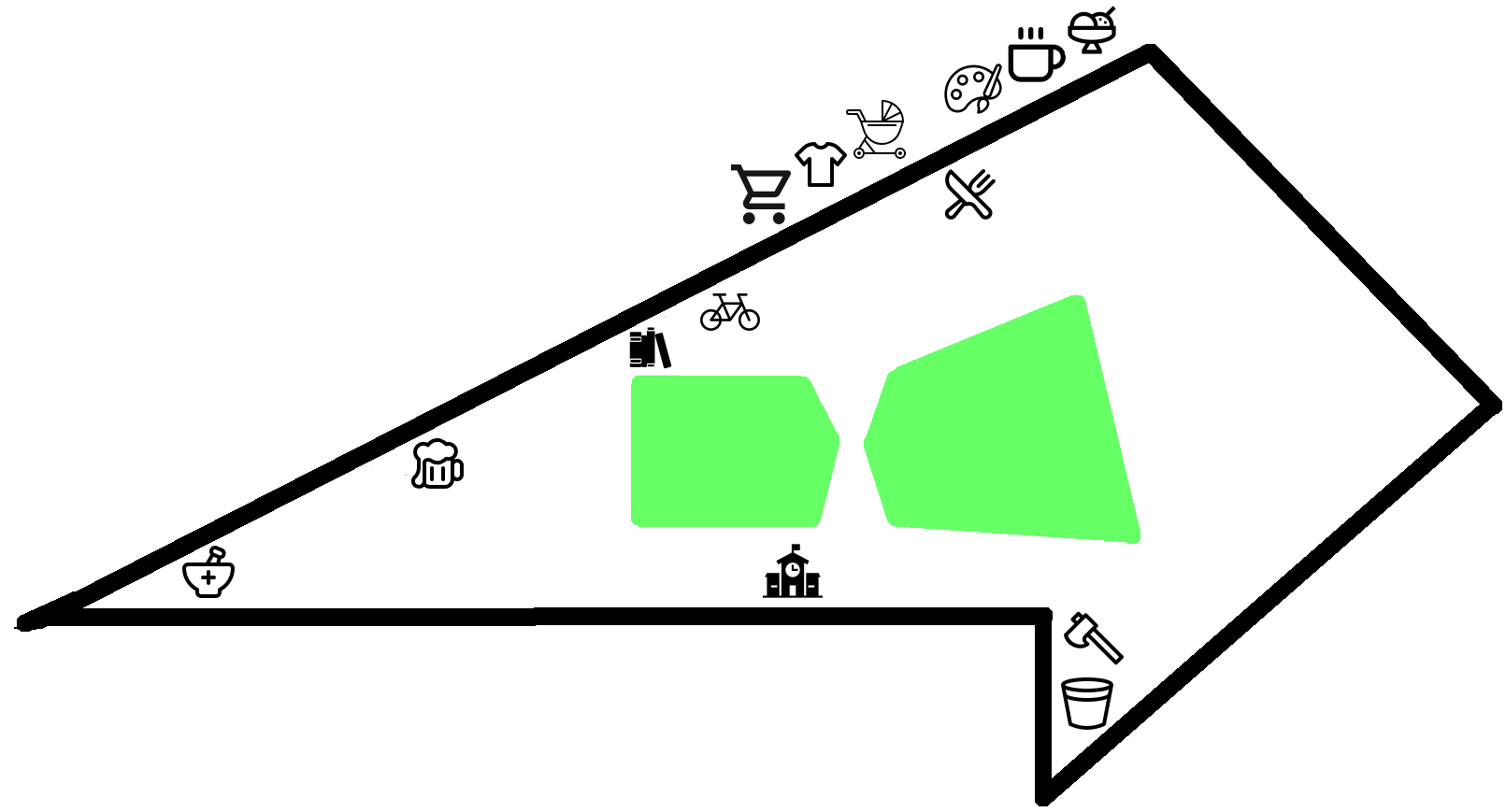
the same one without words
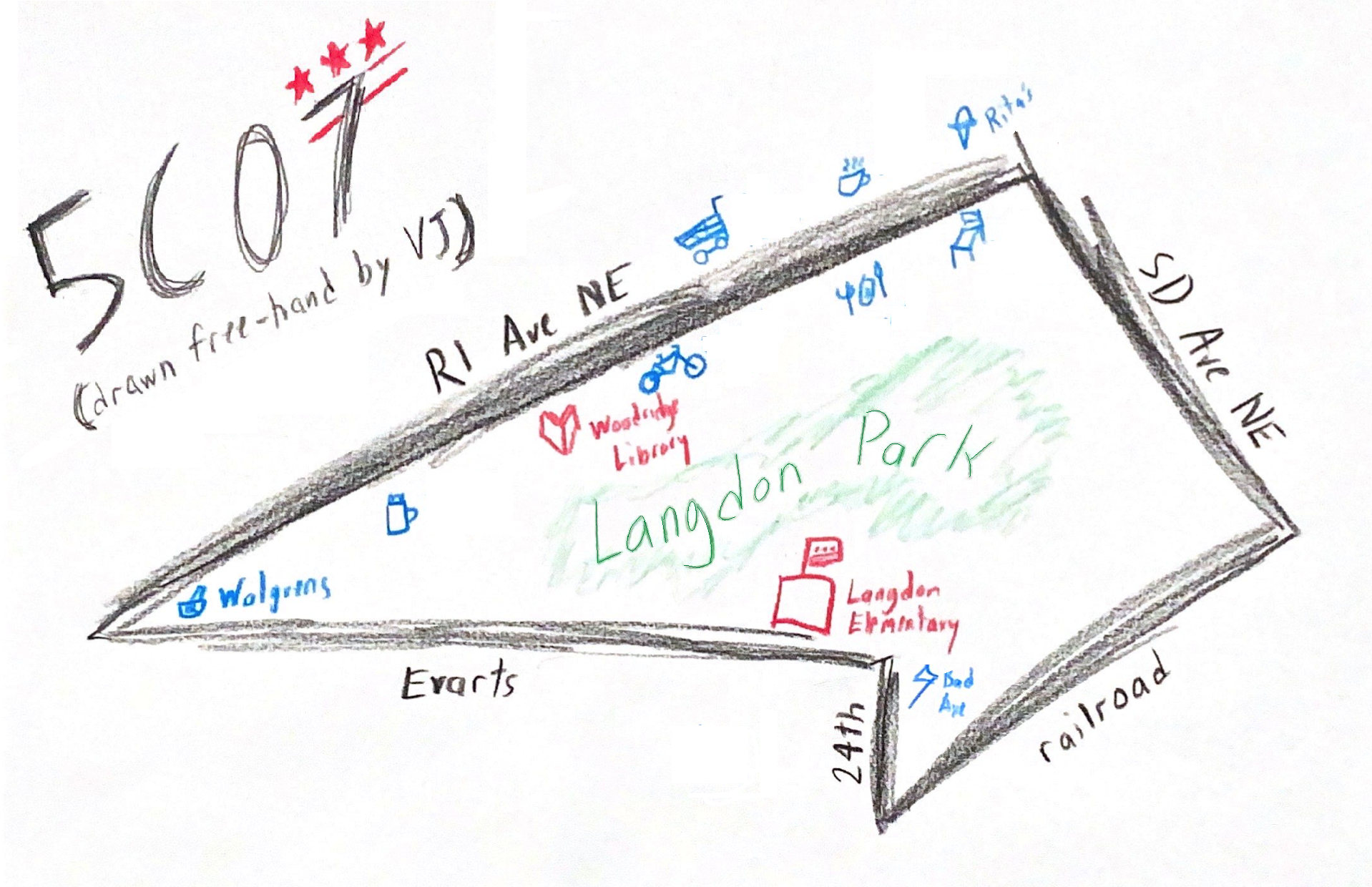
a free-hand map I drew with colored pencils that inspired the above
a designer map adapted by Zach Ammerman (Wild Places Prints) for fancier prints
redistricting
The November 2022 elections took place against the new ANC boundaries, which will take effect in January 2023.
Experienced voters in the neighborhood should take note that 5C07 changed significantly in the 2022 redistricting process, moving both south and west. Effective January 2023 and applying to the November 2022 ANC elections:
- Residents of 5C07 (from 2013-2022) who live north of Rhode Island Ave. NE will live in 5B06
- Residents of 5C06 (from 2013-2022) who live west of 17th St. NE between Rhode Island Ave. NE and Evarts St. NE will live in 5C07
- Residents of 5C02 (from 2013-2022) who live north of the railroad tracks and between 24th St. NE and South Dakota Ave. NE will live in 5C07
If you’re having trouble determining your district, you can check the OpenANC project, the official tool, the static maps, and/or just reach out!