This traffic safety mitigation is on the boundary between 5C07 and 5B06.
The RIA/Thayer HAWK signal install was completed in December 2024; there may be future advocacy to upgrade it to a full traffic signal, but for now folks should make liberal use of the HAWK and focus on advocating for similar installs along RIA at 17th and 15th, both of which are under evaluation. This page remains for reference, but there may be residual future tensing for past events as it’s no longer being regularly updated.
tl;dr
- Rhode Island Ave NE from 20th St NE to 24th St NE is our neighborhood’s “downtown”, containing most of our businesses, amenities, institutions, and new home construction.
- There are traffic lights to allow controlled crosstraffic and pedestrian crossing at 20th, Mills, and 24th, but there are a number of intersections in the 800 feet between Mills and 24th without any traffic signals, and only unsignalized crosswalks
- Neighbors have been pushing for a new signalized crossing for a long time and after I pushed hard on the idea of a new full traffic light at Thayer St (about halfway between Mills and 24th), DDOT has begun designing a HAWK signal here
- DDOT isn’t releasing the Signal Warrant Analysis that might explain why they’re not moving forward with a full traffic signal; we issued a letter on public need to review it, but DDOT’s withholding was upheld by the Mayor’s office on appeal
- Beyond HAWK vs traffic signal, we should collectively push DDOT on prioritizing safety in design similarly for either, and it could go a long way towards enabling safe pedestrian crossing here and allowing a later upgrade
- DDOT presented at a joint 5B06/5C07 SMD meeting on 12/20; this was on DDOT’s request to discuss further in a meeting rather than over email; we probed the warrant analysis and advocated for maximal safety in design
- DDOT issued an NOI on 3/25/2024 and comments are due May 23rd; this is our opportunity to ask for maximal safety, and any possible provisions to later upgrade to a full signal
Community Action
Anyone can submit comments in support or opposition to DDOT’s published Notice of Intent (NOI), NOI-24-85-TESD, to be considered by DDOT as it moves forward into further design and contracting out for install.
Submitting a Letter
To submit a letter:
- send before end-of-day Thursday 5/23/2024 to be sure it’s received in time
- email it to dalando.baker@dc.gov (NOTE A TYPO in the source website; it’s definitely dalando.baker@dc.gov and NOT dolondo.baker@dc.gov)
- include the NOI number (
NOI-24-85-TESD) and title (Installation of a HAWK signal at intersection of Rhode Island Ave and Thayer St, NE) in the subject - including some information about your proximity to the site, and/or residency within 5C07/5B06 if applicable, may help strengthen the weighing of your comments
Template in support with consideration for maximal safety and upgrade capacity
This is a position one may wish to take:
Subject:Letter in Support of NOI-24-85-TESD, Installation of a HAWK signal at intersection of Rhode Island Ave and Thayer St, NE
Mr. Baker:
I’m writing to support the subject HAWK signal installation, with the following hopes for the final design:
- advanced stop lines to mitigate against multiple-threat crashes
- well-designed pedestrian refuge/safety islands that are at least six feet wide, have cut-through ramps the width of the crosswalks, have a median “nose” extending past the crosswalk, and have additional signal activation buttons at the refuge
- median/turn hardening to mitigate against illicit left turns in and out of the Family Dollar parking lot, and harden left turns onto RIA from Thayer
- curb extensions on the north side where there’s 24-hour parking, and drivers frequently park in the intersection and on top of the existing crosswalks
- maximal considerations for later upgrade to a full traffic signal; to the degree possible, electrical service and support poles should be sized to facilitate a near-term upgrade to a full traffic signal, as hundreds of homes and new retail are built nearby and pedestrian traffic increases
Thank you; I look forward to seeing this project progress!
Very respectfully,
(your name)
(your address or SMD)
You can help promote this action by printing/sharing this flyer.
Timetable
An installation like this is way too hard to get and takes way too long to deliver. If we want to maximize our return on our limited advocacy capacity, it’s important to focus on where we are in the process. The past dates below are based on when DDOT has revealed information. The future dates are my best guesses based on recent similar installs (DDOT’s productivity is likely decaying over time). It is not likely worth our time to try to extract predictions on future events from DDOT.
- long-standing advocacy: on a safe crossing here has been long-standing. Folks like Ms Elmira have been working on this for years, including bringing it up at many 5C07 SMD meetings last term before I became Commissioner. While I want to recognize this and emphasize that this is very much a community ask and not just my own project, the timetable for this particular installation begins with the associated “Service Request”
- input (9/14/2022): the current work on this investigation began with the #All4Allie campaign to flag unsafe road conditions in honor of Allie Hart. There were several #All4Allie submissions from neighbors around this crossing, including SR 22-00443225 in which I specifically requested consideration for a full traffic light at Thayer to cross RIA.
- investigation (?): like many #All4Allie submissions, there is some uncertainty about whether this entered directly into the “investigation” queue or was throttled as an “input” that then had to be algorithmically selected for prioritization. This one dropped from the input/investigation dashboard entirely, and the corresponding SR was closed on 2/7/2023 rather than 1/6/2023 like most “inputs.” While SRs asking for this exact thing have been opened subsequently, the follow-up steps have been conveyed only over emails with DDOT.
- study/evaluation (3/24/2023): in DDOT-speak, “investigations’ tether to the nearest intersection and then spur “evaluations” at the intersection and/or adjacent blocks. I found out from an email exchange between DDOT and Ms Elmira on 3/24 that my specifically requested traffic signal at RIA/Thayer was being studied by DDOT Traffic Engineering and Signals Division (TESD). This is a good example of the progress we can make when residents ask DDOT pointed questions about their work in our neighborhoods, cite specific Service Request numbers, and CC me (they get a little numb to my questioning, but it’s great to have someone to volley off of).
- recommendation (10/31/2023): after being asked many, many times by Ms Elmira and myself, and in a thread responsive to my conditions on the nearby 2000 block of Hamlin speedhumps, I learned that DDOT was proceeding to design on a HAWK signal here, and would present to an ANC meeting about it.
- design (unknown when completed): At the 12/20 meeting, we pushed DDOT on maximizing safety in the design, to include an advanced stop line, a pedestrian refuge, turn-hardening surrounding the intersection, and provising a button to re-initialize the signal in the median
- work order under production (unknown when completed): Not entirely clear on how this process works, as DDOT is not very transparent in how it operates.
- Notice of Intent (3/25/2024; comments due 5/9/2024): DDOT is legally obligated to issue a Notice of Intent (NOI) for this work, at which point there will be a 45-day public comment period wherein advocating for safety improvements not part of the NOI will also be an option. I hope to make maximal use of this phase of the process as well.
- installation (maybe February 2025?): Georgia/Hamilton is a recent example of installation taking around a year after NOI closing.
- activation (maybe by December 2025): The aforementioned Georgia/Hamilton HAWK is still not activated eight months later as of this writing. On 12/4/2023, DDOT indicated to former-Cmsr Israel that the design and production of the electrical components to facilitate activation of Georgia/Hamilton would take another nine months. We should anticipatorily start getting commitments on this foreseeable problem after NOI issuance, but not before.
The long timetable is part of why it’s so important to try for the full signal now rather than moving too quickly to allowing the HAWK to proceed for a later upgrade. There is likely a 2-3 year lag time at least if we have to go through two cycles here, provided DDOT’s productivity is not fundamentally improved (and the trendlines may favor a decrease).
While I would very much like to see the timetables moved up, I do want to stay focused 10% on recommendation to try to secure a full traffic signal, and beyond that 90% on design to maximize safety for either HAWK or full traffic signal.
If folks have questions or concerns about why a safer crossing here is necessary at all (in effect relitigating earlier phases), it would be great to direct them to me rather than DDOT. I am happy to spend time dicussing this need with folks to avoid taking up limited time with DDOT, so folks understand why I will only be pushing DDOT to proceed from here on out (as I have been).
Traffic Signal warrants
The determination of whether an intersection should receive a full traffic signal is based on “warrants” (criteria threshold) prescribed by the Manual on Uniform Traffic Control Devices (MUTCD). There are 8 warrants. While I’m still working on getting this analysis for RIA/Thayer, it’s safe to assume that DDOT did not assess any of the warrants were met, and is pursuing a HAWK signal as an alternative.
Depending on what I eventually find, we may want to push back on the warrant analysis and continue working for a full traffic signal. However, there are a lot of important improvements to the intersection we can likely get in scope for the HAWK signal design, which would then vastly improve the starting point for a future upgrade to a full traffic signal.
With the warrant analysis in hand, we could also be vigilant to log issues that might change the outcome on re-analysis, particularly in regardes to Warrant #7, which considers crashes that a full traffic signal could potentially have prevented.
On 11/20, my FOIA request was denied citing deliberative process privilege. Despite DDOT moving forward with the HAWK design, the 30-page warrant analysis is still in draft, and therefore not subject to public release. My FOIA request for another HAWK signal that’s substantially installed (but not yet activated) at Georgia Ave NW and Hamilton St NW yielded a similar denial, indicating that DDOT does not finalize warrant analyses at any point for intersections it prescribes HAWK signals to. I will be pushing DDOT to finalize this document and ideally releasing it at our meeting. It’s also possible to push them on this through ANC resolutions by ANC 5B or 5C.
HAWK signals
You can read general information about HAWK signals and DDOT’s information about HAWK signals. I’ll attempt to grab some photos of existing signals in DC. The nearest one to us, at South Dakota Ave NE and Ingraham St NE near the Lamond-Riggs/Lillian J Huff library, was recently upgraded to a full traffic signal. If you happen to have any demonstrative photos of that signal before the upgrade or other cases around DC, feel free to send them my way.
HAWK ambitions
There are a number of things we should push for in the HAWK design:
- an advanced stop line: these indicators of where to stop ahead of the crosswalk are important to avoid drivers in one lane from entering the crosswalk due to a pedestrian in the crosswalk being blocked by an adjacent stopped driver (these are known as “multiple-threat crashes”; this is especially important for a crossing of six lanes of high-speed traffic. DDOT does not always provision these in their HAWK designs.
- median hardening: this will be tactical (using flexposts and prefabricated concrete, not poured concrete and granite) and there won’t be much of an actual pedestrian refuge, but we can do the best we can implementing turn elimination through more median hardening; DDOT has implemented the elimination of some turning manuevers as part of HAWK implementation design in other cases
- curb extensions on the north side where there’s 24-hour parking, so truck drivers stop parking over the crosswalks (this can’t be done on the south side as present as it’s a through lane during evening rush-hour)
Present Condition
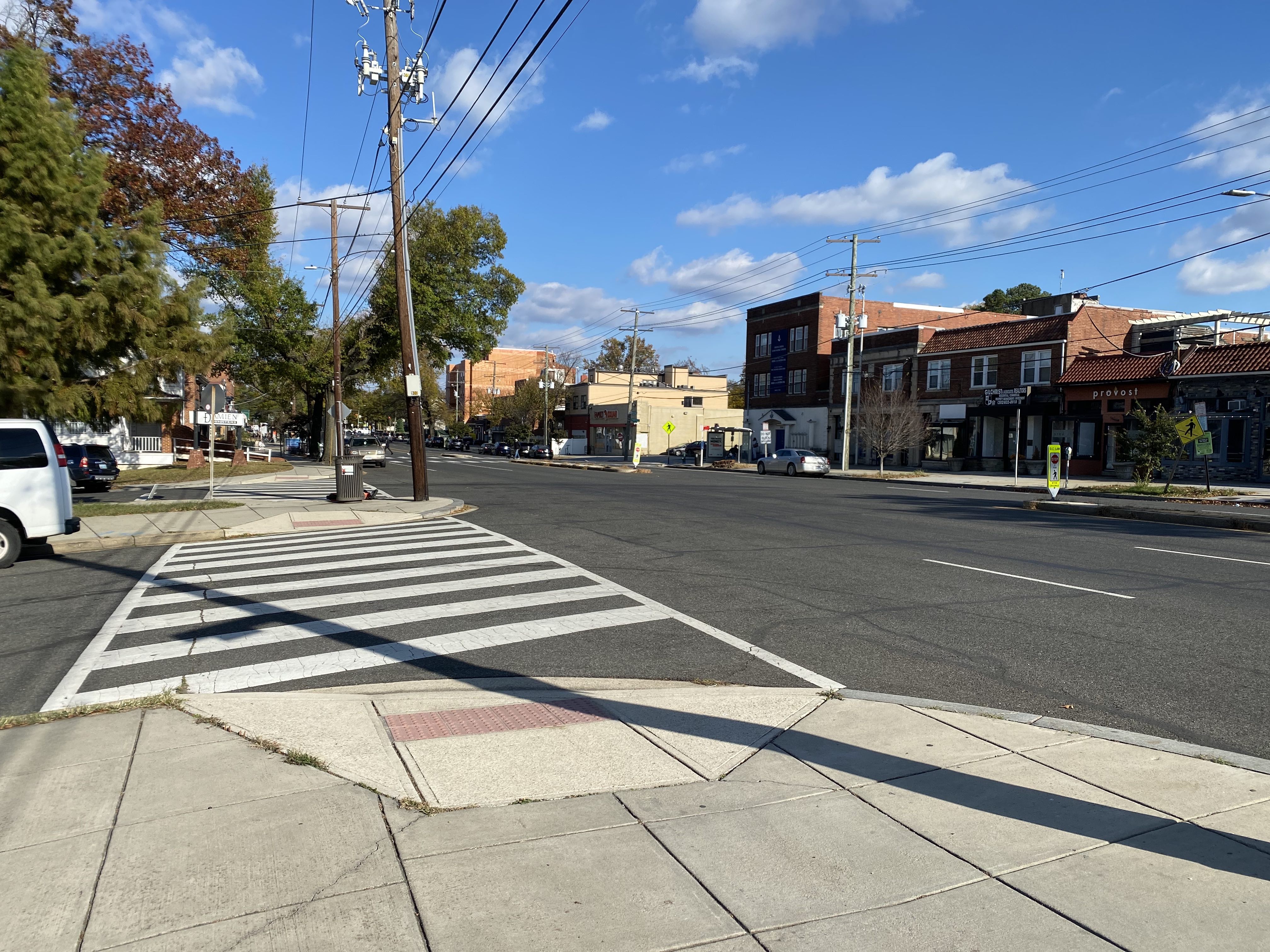
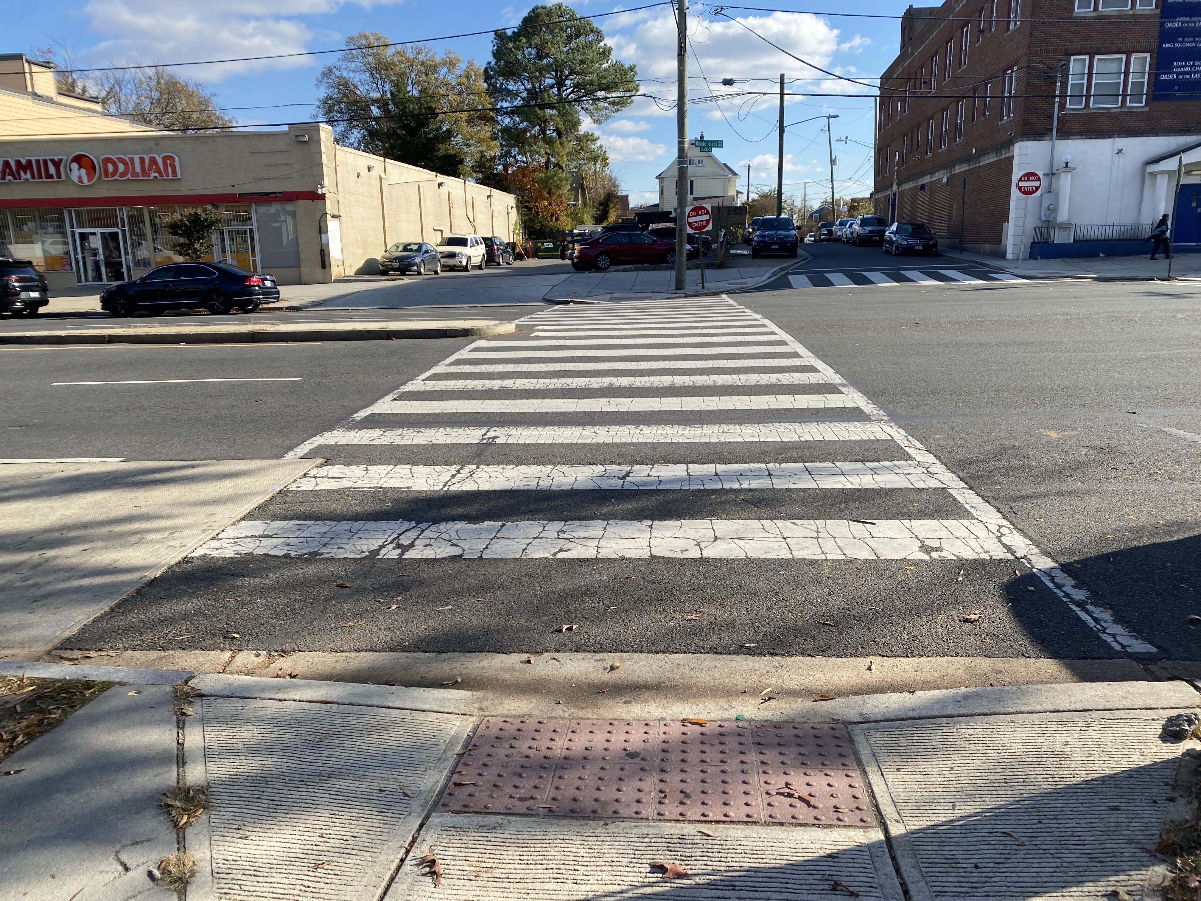
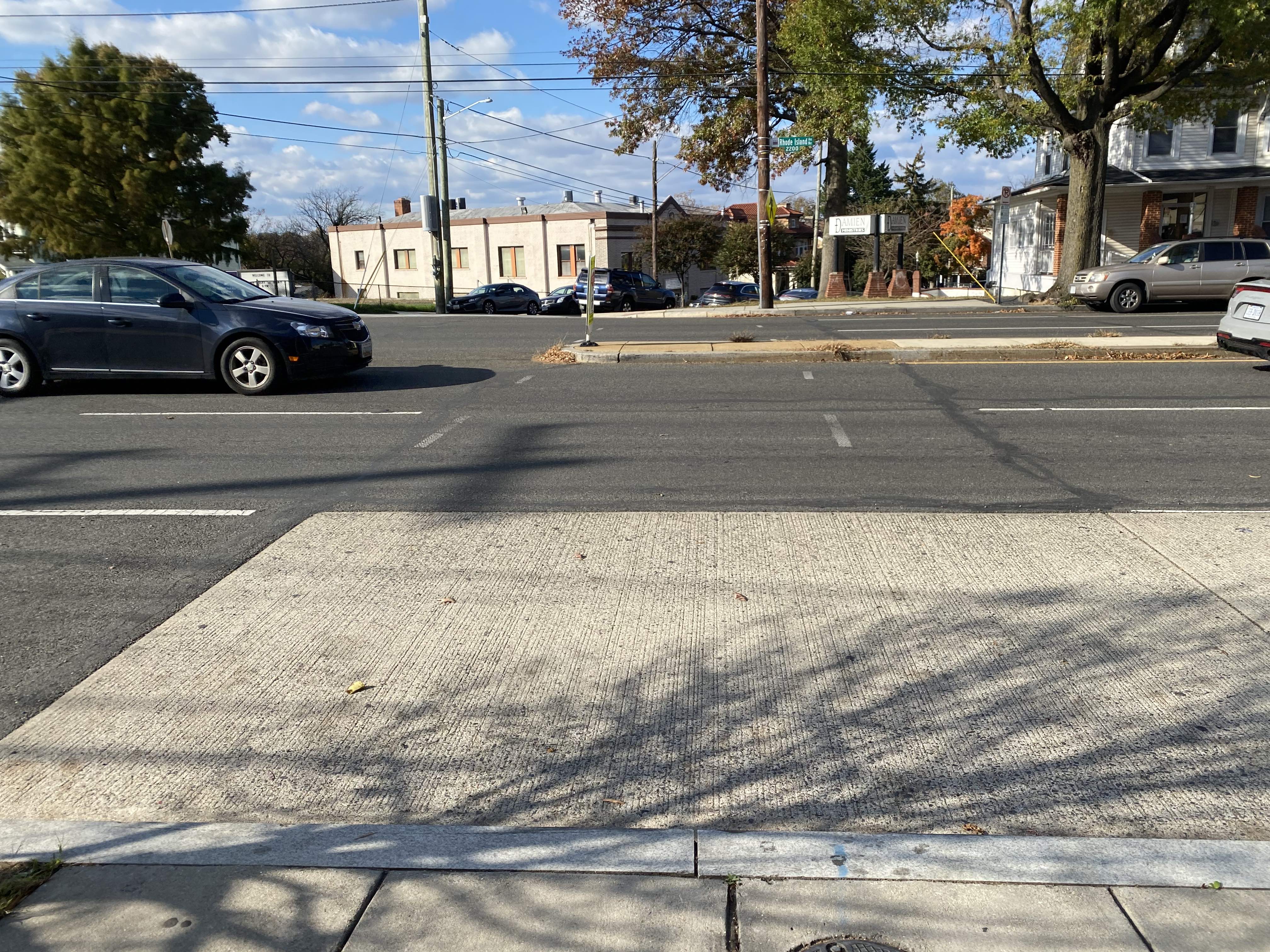
The subject intersection is where Thayer St NE meets Rhode Island Ave NE. Thayer St is a one-way northbound street that terminates on RIA, so drivers only turn off Thayer and onto RIA, though this includes many left turns across 3-5 lanes of traffic.
intersection from the southwest
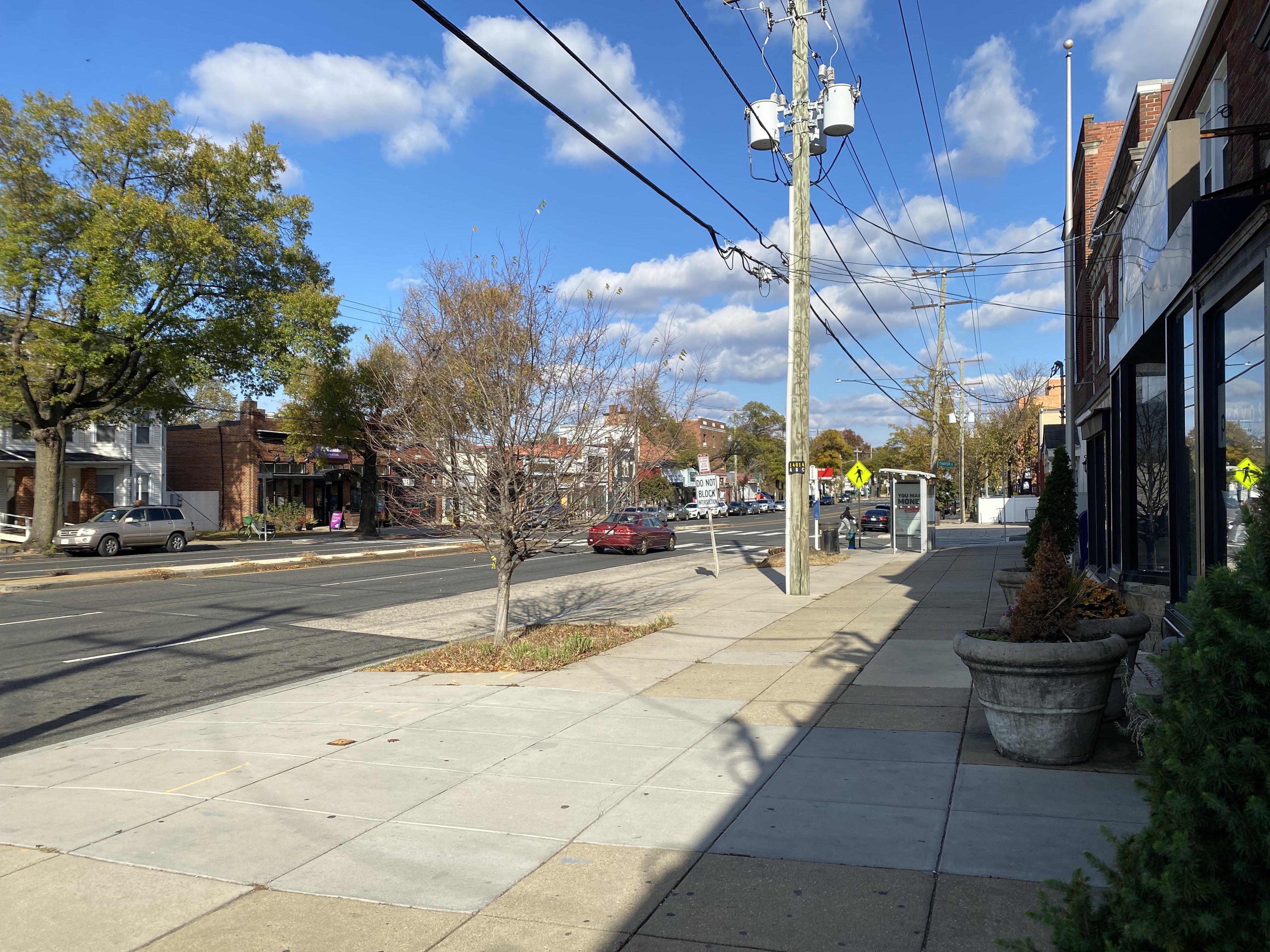
Thayer is narrow and grid non-conforming. It runs perpendicular to RIA for 800 feet from 24th St NE to subject intersection. The road is 18’ wide with one driving lane, one left/west-side parking lane, and a single extremely narrow sidewalk running along the west side. An east side walkway exists on the northern end by RIA, but it’s entirely on Family Dollar’s property and this is currently used as car parking most of the time.
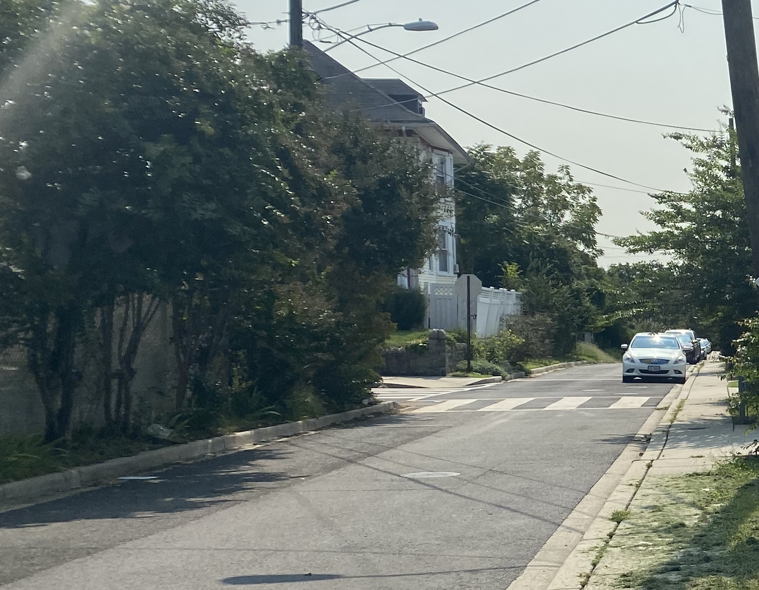
Thayer St at the intersection with Woodridge St NE looking south
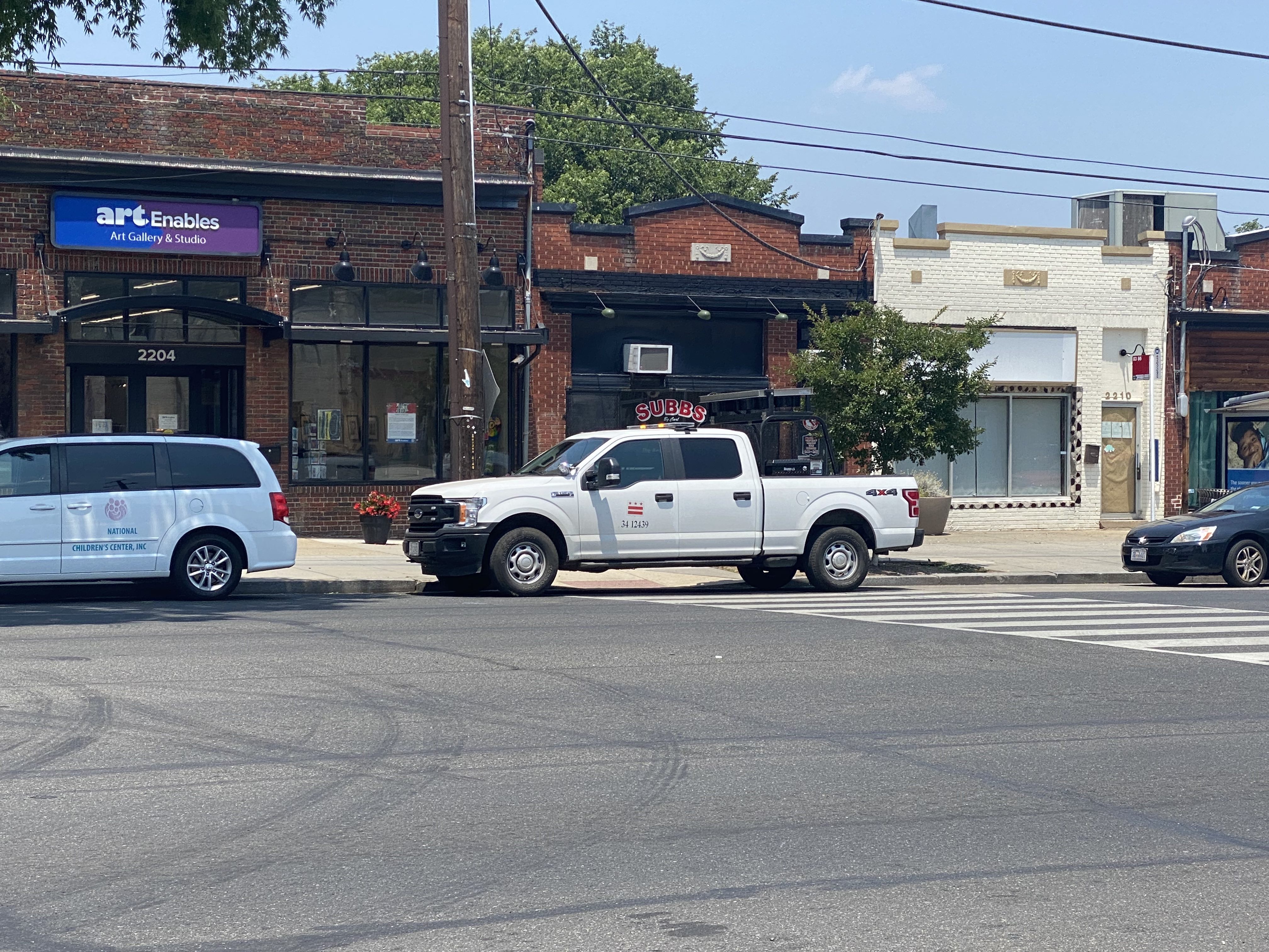
The intersection has two striped crosswalks across RIA, but no signals. While pedestrian activity in this area is heavy, drivers usually do not stop or slow down for pedestrians here. To walk from the US Post office on one side of the intersection to Art Enables on the other at safe and controlled intersections, one must walk 400 feet west to Mills or 400 feet east to 24th, and back on the other side.
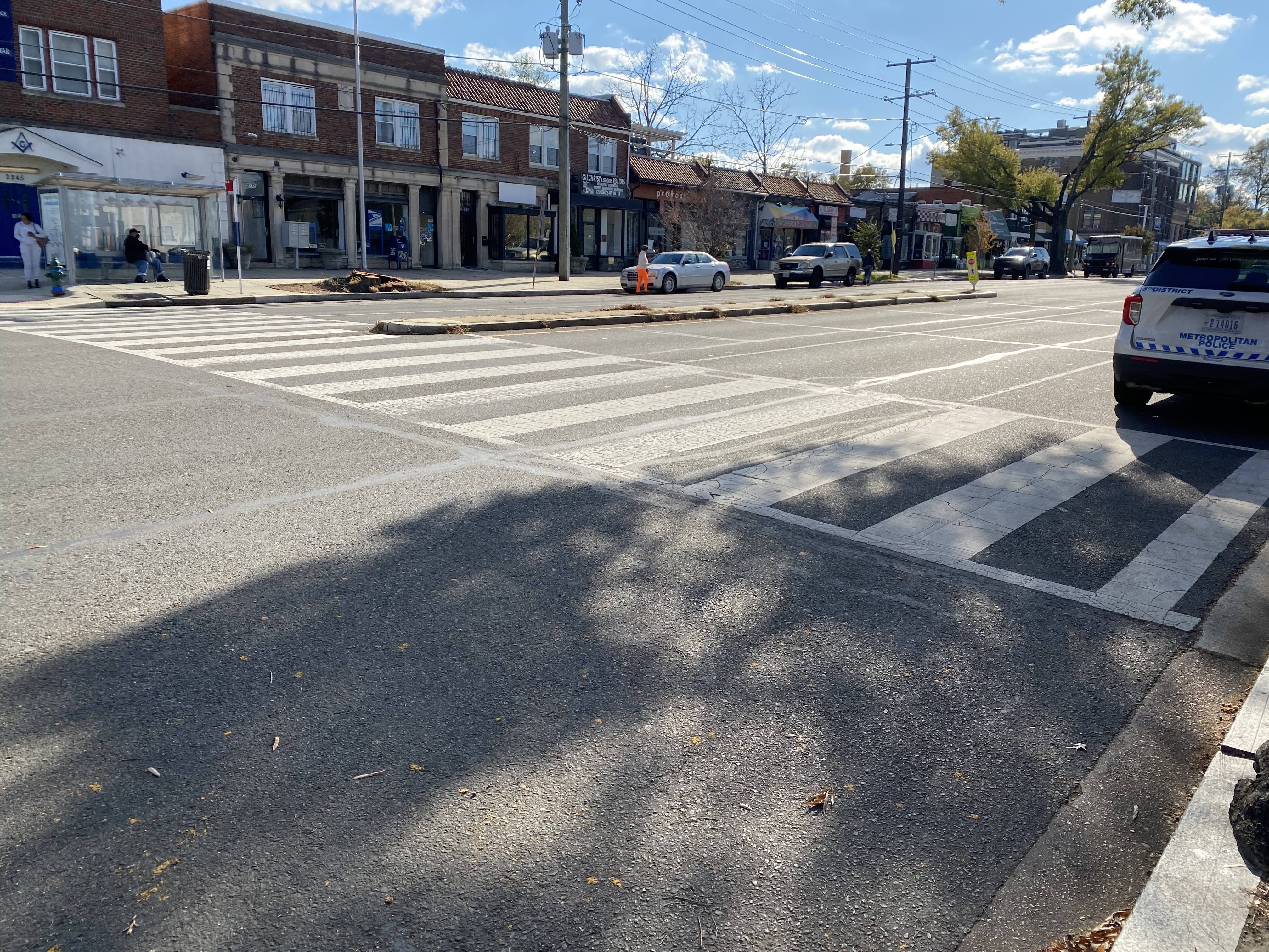
west crosswalk from the northeast
On the north side, the retail blocks surrounding the crosswalk have 24-hour parking. On the south side, parking is off-peak only (though I’m hoping that will eventually change), so the crosswalks spans five lanes of through traffic during those times. There are some small segments of raised median immediately east and west of the crosswalks, but no protected pedestrian refuge at the median.
east crosswalk from the north
Despite the 24-hour parking on the north, no curb extensions have been installed, so drivers frequently park across the crosswalk, in the no parking area between the crosswalks, and in the no-parking area of the adjacent 83/86 bus stop.
various illegally parked cars around the east crosswalk
There are also a lot of chaotic driver manuevers occurring around the intersection.
Jackson and 22nd St intersections
Immediately west of the subject intersection, Jackson St NE and 22nd St NE each terminate on the north side of RIA in quick succession. This area area splits the north side of RIA between 20th St NE and 24th St NE into two.
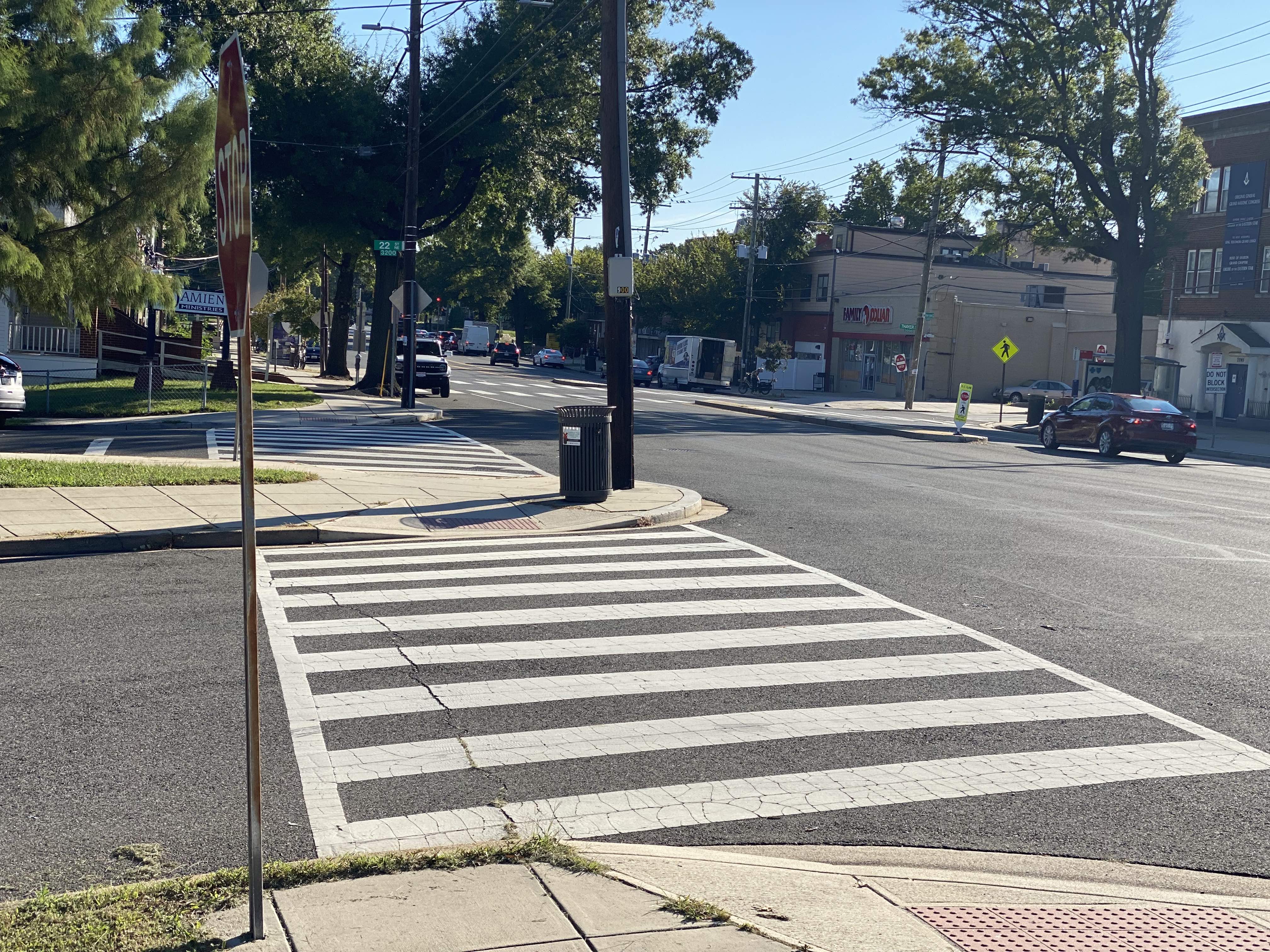
Jackson St NE and 22nd St NE crosswalks along RIA from the west
This corner is also planned for 45 homes, 3700 SF of retail, and around 2000 SF of outdoor patio area as part of the 2026 Jackson St NE project on a gravel lot and concurrent 3200 22nd St NE project within the existing church structure behind that.
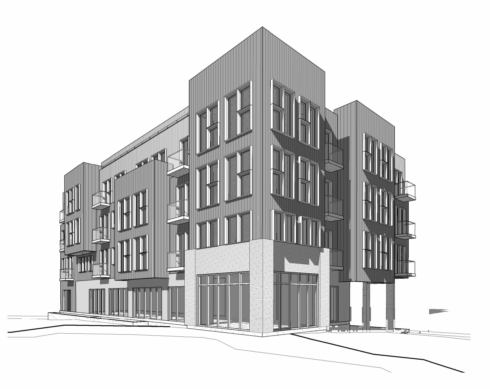
2026 Jackson rendering, from the southeast
Drivers often make left turns to and from RIA on both 22nd St NE and Jackson St NE at high merging speeds.
22nd St crosswalk
There are some remnants of a third crosswalk where 22nd St NE terminates on RIA on the north side of the street. Like the two Thayer St crosswalks, this crosswalk received updated crosswalk striping between 2011 and 2014, but by 2015 the street was repaved without striping the 22nd St crosswalk, and sidewalk work that upgraded ramps with detectible warning pavers (aka bumpies) removed the ramps leading to the 22nd St crosswalk (due to the form of the raised concrete median across the crosswalk, this crossing was never appropriately wheelchair-accessible).
22nd St crossing from the south
There are, inexplicably, crosswalk signs in the median at the mostly unmarked 22nd St crossing. It’s impressive if they’ve survived since 2015 without maintenance. The hashmarks outlining this crosswalk are fading relative to the other roadway striping around it, so it appears to have not been maintained.
On 9/12/2022, Rebecca Melsky submitted Roadway Striping SR 22-00438072, to properly stripe the 22nd St crosswalk. Her opening comment reads:
There are some short white lines, but not a full crosswalk on Rhode Island. There are yellow pylons, but traffic rarely stops even when I am standing with three children waiting to cross the street. Parking on Rhode Island often gets too close to 22nd to allow for proper visibility by pedestrians onto RI for safe crossing. Submitted in memory of Allie Hart. #allforallie
On 3/24/2023, after Ms. Elmira asked about this SR, DDOT responded:
This service request is still open and has not been evaluated yet. I will reach out to our paving team to gage a timeline. Please note that our paving work picks up in the Spring as weather does not permit markings in fall/winter
As of 11/2/2023, this SR remains open with an expected resolution of 9/29/2023 for a ticket opened 9/12/2023. DDOT’s standard is to investigate and respond to pavement marking requests within 75 days.. I just emailed for a status update on this SR specifically and for any official story on this crosswalk generally and will update here if I hear back.
Family Dollar parking lot
Immediately east of the subject intersection, a small parking lot adjacent to Family Dollar also acts as an additional intersection. The parking lot has access points from both RIA and Thayer St, though it generally functions as a loop from RIA to Thayer and back due to Thayer being one-way.
While a raised concrete median sort of blocks left turns into and out of the Family Dollar parking lot, in practice drivers commonly perform this manuever.
Family Dollar parking lot entrance past the median from the north
Recent Advocacy timeline
Progress on this is a good case study of how things tend to work with DDOT; there are many investigations/evaluations that appear to float around at the agency without being addressed until they’re pushed into action with precise recognition of DDOT’s own purported operating procedures and Service Request details.
Ms. Elmira Jones has been pushing for upgrading the crossings in this vicinity for a long time. She discussed the need on several SMD meetings in late 2022, but the advocacy stretches back much further.
On 9/13/2022, I opened Traffic Safety Investigation Service Request (TSI SR) 22-00443225 specifically for a full traffic light at Thayer St NE. This was part of the #All4Allie campaign to honor five-year-old Allie Hart on the anniversary of her tragic passing.
This TSI SR started under the communal first-in/first-out six-month investigation protocol in place from November 2021 through December 2022. Prior to November 2021, TSI submission was marshalled by the SMD Commissioner, and by September 2022, the new protocols were still shaky and subject to an unclear Commissioner veto. By September, we could be confident submissions would yield recommendations only once new Commissioners were seated and a priority shift around this area of RIA was imminent, so it was a good time to start loading up the pipeline with comprehensive (and, in this case, experimentally ambitious) investigation requests.
Some #All4Allie TSI SRs went through investigation before the next policy shift to quarterly algorithmic prioritization rather than first-in/first-out. Nearby examples include speedhumps on Girard Pl, 25th St, and 26th St. Many others were “pooled” on 1/6/2023 for later consideration in the new prioritization scheme, though the TSI dashboard did not clearly indicated SRs in the “pool” for case-by-case clarity on this (those upgrades came around May 2023).
On 3/2/2023, Ms. Elmira wrote an email to DDOT pushing once again on this critical need with some specific citations I recommended along with dangerous situations she’d witnessed:
SR 22-00443225 - Install a Traffic Light at Thayer St. which is a 1-way heading north at RIA. To emphasize the danger of not having a traffic light, 1) pedestrians can safely cross 4 lanes of roadway; 2) when coming out of Thayer onto RIA, driver has to cross the white lines in order to see the oncoming traffic heading east and/or then navigate crossing to turn left onto RIA. Additionally, at times there are trucks parked at the driver’s side corner of Thayer which also has a bus stop shelter.
To which Ward 5 Community Engagement Specialist Dalando Baker responded:
DDOT Traffic Engineering and Signal Division has received the request to have a traffic signal installed. The location has been advanced for Traffic Signal study to determine the need for a traffic signal and/or safety improvements. Thank you for bring this issue to our attention and for your interest in traffic operations. Any update on the study can be provided by Mr. Rahul Jain…
Several subsequent emails from both Ms. Elmira and myself went unresponded to. I did briefly discuss the matter and its importance directly with Mr. Jain at the DDOT Open House for ANCs on 5/20/2023.
On 7/18/2023, Matthew Sadler submitted TSI SR 23-00374383 for the same need, stating:
The intersection of Thayer Street and Rhode Island Avenue in Northeast DC. Despite the abundance of shops and restaurants on each side of Rhode Island, this intersection has two unsignalized crosswalks. Pedestrians wait for gaps in traffic, because drivers don’t stop.
I flagged to DDOT on 8/25/2023 during another round of emails that additional asks were piling up in the pool of TSIs for future consideration to emphasize:
- issues created by the time lag in investigating, and
- issues created by poor feedback/grouping mechanisms in the TSI system for submissions redundant with open investigations.
Again, we received no response.
On 10/24/2023, I issued a letter regarding speedhumps on the 2000 block of Hamlin St NE, which conditioned support specifically on keeping nearby investigations open. In response, DDOT sent a comprehensive list of evaluations within 5C07 that remain ongoing and their current status. This traffic signal assessment was not on the list; I immediately flagged it among the items that were missing:
- Thayer St NE and Rhode Island Ave NE; last I heard, SR 22-00443225 was with Rahul Jain for Traffic Signal Assessment. I know Ms. Elmira and other neighbors have tried to get a status from him and CCed you over the past few months, but nobody has heard back. I think the last email from you on the topic is from 3/24. Is there a status for this investigation? As with the 2800-2900 block of 20th, this is a location where redundant new tickets are coming in as folks independently observe the need during DDOT’s ongoing evaluation , but it was not directly addressed in the response.
While I did receive a response on other items in the list, this one was among the items still awaiting internal response.
A week later on 10/31/2023, I checked in to see if there were an updates on the remaining items including this signal assessment. In response I received:
Hawk signal is currently under design. DDOT will be attending ANC 5C public meeting 11/15 and 7pm to share additional information and answer and questions.
We had some subsequent back and forth to establish:
- an ANC meeting would not be a precondition for moving forward on the design, though it’s the preferred method of discussing the matter because “the engineer designing this safety installation would prefer to vet questions/feedback during the meeting instead of a lot of email follow up”
- since the subject intersections is on the 5B/5C boundary and wouldn’t require a vote at this time, the appropriate venue for a presentation is the 5B06/5C07 Joint SMD meeting which typically occurs on fourth Wednesdays; we are deliberating on when we might have this meeting during (or after) the holidays
- I did start writing out some immediate questions on the scope of this project; while I never received answers, I did find some exemplars of other HAWK signal Notices of Intent that answered most of them
On 12/20/2023, we had an extensive discussion with DDOT on this matter in a public SMD meeting.
On 3/25/2024, DDOT issued a Notice of Intent to install the HAWK signal.